

Kennet & Avon Canal
A cycling route starting in Thatcham, England, United Kingdom.
Overview
About this route
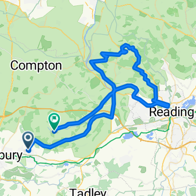
Kennet & Avon Canal route from Thatcham to Bath
- -:--
- Duration
- 97.9 km
- Distance
- 258 m
- Ascent
- 306 m
- Descent
- ---
- Avg. speed
- 155 m
- Max. altitude

Route quality
Waytypes & surfaces along the route
Waytypes
Pedestrian area
58.7 km
(60 %)
Cycleway
36.2 km
(37 %)
Surfaces
Paved
4.9 km
(5 %)
Unpaved
79.3 km
(81 %)
Gravel
42.1 km
(43 %)
Ground
32.3 km
(33 %)
Continue with Bikemap
Use, edit, or download this cycling route
You would like to ride Kennet & Avon Canal or customize it for your own trip? Here is what you can do with this Bikemap route:
Free features
- Save this route as favorite or in collections
- Copy & plan your own version of this route
- Split it into stages to create a multi-day tour
- Sync your route with Garmin or Wahoo
Premium features
Free trial for 3 days, or one-time payment. More about Bikemap Premium.
- Navigate this route on iOS & Android
- Export a GPX / KML file of this route
- Create your custom printout (try it for free)
- Download this route for offline navigation
Discover more Premium features.
Get Bikemap PremiumFrom our community
Other popular routes starting in Thatcham
 50km Brimpton North
- Distance
- 49.5 km
- Ascent
- 296 m
- Descent
- 294 m
- Location
- Thatcham, England, United Kingdom
 Muddy Lane, West Berkshire to 15 Rhigos, Reading
- Distance
- 28.3 km
- Ascent
- 87 m
- Descent
- 108 m
- Location
- Thatcham, England, United Kingdom
 Fox & Dog - Coombe to Hannington via Wayfairers Walk
- Distance
- 66.4 km
- Ascent
- 1,538 m
- Descent
- 1,538 m
- Location
- Thatcham, England, United Kingdom
 Sunday Ride
- Distance
- 62.4 km
- Ascent
- 474 m
- Descent
- 470 m
- Location
- Thatcham, England, United Kingdom
 NCR4 Thatcham to Waybridge
- Distance
- 85.5 km
- Ascent
- 186 m
- Descent
- 241 m
- Location
- Thatcham, England, United Kingdom
 Kennet & Avon Canal
- Distance
- 97.9 km
- Ascent
- 258 m
- Descent
- 306 m
- Location
- Thatcham, England, United Kingdom
 Recovered Route
- Distance
- 72.1 km
- Ascent
- 2,145 m
- Descent
- 2,170 m
- Location
- Thatcham, England, United Kingdom
 The Block
- Distance
- 9.9 km
- Ascent
- 41 m
- Descent
- 44 m
- Location
- Thatcham, England, United Kingdom
Open it in the app