
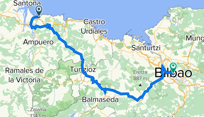
Calle Menéndez Pelayo, 5, Laredo to Plaza Federico Moyua, Bilbao
A cycling route starting in Laredo, Cantabria, Spain.
Overview
About this route
- 4 h 23 min
- Duration
- 76.4 km
- Distance
- 1,756 m
- Ascent
- 1,732 m
- Descent
- 17.4 km/h
- Avg. speed
- 416 m
- Max. altitude

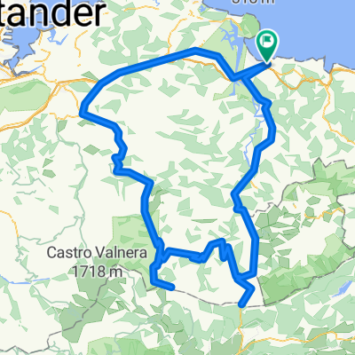
Route quality
Waytypes & surfaces along the route
Waytypes
Quiet road
20.4 km
(27 %)
Road
19.8 km
(26 %)
Surfaces
Paved
36.2 km
(47 %)
Unpaved
5.6 km
(7 %)
Asphalt
32.7 km
(43 %)
Gravel
5.6 km
(7 %)
Continue with Bikemap
Use, edit, or download this cycling route
You would like to ride Calle Menéndez Pelayo, 5, Laredo to Plaza Federico Moyua, Bilbao or customize it for your own trip? Here is what you can do with this Bikemap route:
Free features
- Save this route as favorite or in collections
- Copy & plan your own version of this route
- Sync your route with Garmin or Wahoo
Premium features
Free trial for 3 days, or one-time payment. More about Bikemap Premium.
- Navigate this route on iOS & Android
- Export a GPX / KML file of this route
- Create your custom printout (try it for free)
- Download this route for offline navigation
Discover more Premium features.
Get Bikemap PremiumFrom our community
Other popular routes starting in Laredo
 Laredo -Estacion de Esqui Lunada
- Distance
- 204.7 km
- Ascent
- 4,853 m
- Descent
- 3,579 m
- Location
- Laredo, Cantabria, Spain
 17. Etappe Laredo - Comillas ca. 109km 04.07.
- Distance
- 110.3 km
- Ascent
- 533 m
- Descent
- 561 m
- Location
- Laredo, Cantabria, Spain
 Laredo-Arredondo-Alisas-Lunada
- Distance
- 94.4 km
- Ascent
- 0 m
- Descent
- 0 m
- Location
- Laredo, Cantabria, Spain
 Laredo-Lunada-La Sía-Laredo
- Distance
- 136.2 km
- Ascent
- 1,809 m
- Descent
- 1,812 m
- Location
- Laredo, Cantabria, Spain
 Laredo – Castro Urdiales
- Distance
- 165.9 km
- Ascent
- 4,680 m
- Descent
- 4,530 m
- Location
- Laredo, Cantabria, Spain
 Alisas_LaSia_LosTornos
- Distance
- 153.8 km
- Ascent
- 2,447 m
- Descent
- 2,446 m
- Location
- Laredo, Cantabria, Spain
 Laredo-Riaño-Alisas-Laredo
- Distance
- 99.3 km
- Ascent
- 890 m
- Descent
- 893 m
- Location
- Laredo, Cantabria, Spain
 campo la cruz, torcollano, seña
- Distance
- 75.6 km
- Ascent
- 1,025 m
- Descent
- 1,021 m
- Location
- Laredo, Cantabria, Spain
Open it in the app