

Historischer Pfad
A cycling route starting in Löningen, Lower Saxony, Germany.
Overview
About this route
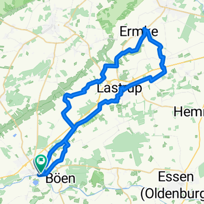
The historic path in Löningen leads you through the 'Wiek', which is the town center of Löningen, and the local districts of Werwe, Evenkamp, Helmighausen, Augustenfeld, and Borkhorn. Along the way, you will encounter pure nature, from forests to fields, and the river 'Hase' is not far away. Historical panels provide information on places, buildings, and history.
- -:--
- Duration
- 16.3 km
- Distance
- 27 m
- Ascent
- 24 m
- Descent
- ---
- Avg. speed
- 34 m
- Max. altitude
Route quality
Waytypes & surfaces along the route
Waytypes
Quiet road
6.8 km
(42 %)
Road
4.1 km
(25 %)
Surfaces
Paved
9.8 km
(60 %)
Unpaved
2.9 km
(18 %)
Asphalt
9.8 km
(60 %)
Ground
1.1 km
(7 %)
Continue with Bikemap
Use, edit, or download this cycling route
You would like to ride Historischer Pfad or customize it for your own trip? Here is what you can do with this Bikemap route:
Free features
- Save this route as favorite or in collections
- Copy & plan your own version of this route
- Sync your route with Garmin or Wahoo
Premium features
Free trial for 3 days, or one-time payment. More about Bikemap Premium.
- Navigate this route on iOS & Android
- Export a GPX / KML file of this route
- Create your custom printout (try it for free)
- Download this route for offline navigation
Discover more Premium features.
Get Bikemap PremiumFrom our community
Other popular routes starting in Löningen
 Löningen - Cloppenburg - Lindern - Löningen
- Distance
- 60.4 km
- Ascent
- 81 m
- Descent
- 81 m
- Location
- Löningen, Lower Saxony, Germany
 Löningen - Cloppenburg - Essen - Löningen
- Distance
- 61.7 km
- Ascent
- 65 m
- Descent
- 64 m
- Location
- Löningen, Lower Saxony, Germany
 Hase-Ems-Tour (Tag3)
- Distance
- 58 km
- Ascent
- 46 m
- Descent
- 49 m
- Location
- Löningen, Lower Saxony, Germany
 Von Löningen bis Leeuwarden
- Distance
- 180.9 km
- Ascent
- 284 m
- Descent
- 306 m
- Location
- Löningen, Lower Saxony, Germany
 LG010509
- Distance
- 40.9 km
- Ascent
- 45 m
- Descent
- 38 m
- Location
- Löningen, Lower Saxony, Germany
 Parkplatz Hasestraße - Torfcafe
- Distance
- 33.6 km
- Ascent
- 29 m
- Descent
- 30 m
- Location
- Löningen, Lower Saxony, Germany
 Historischer Pfad
- Distance
- 16.3 km
- Ascent
- 27 m
- Descent
- 24 m
- Location
- Löningen, Lower Saxony, Germany
 Mundräuberroute
- Distance
- 39.8 km
- Ascent
- 30 m
- Descent
- 30 m
- Location
- Löningen, Lower Saxony, Germany
Open it in the app