

Lucainena de las Torres-Polopos-Lucainena
A cycling route starting in Lucainena de las Torres, Andalusia, Spain.
Overview
About this route
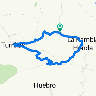
Starting of at the former station follow the newly reformed railway line (Green Route/Via Verde) until it joins the road approx 3km - after this point most of the former line has been tarmaced from Rambla Honda onwards.
- -:--
- Duration
- 23.1 km
- Distance
- 514 m
- Ascent
- 514 m
- Descent
- ---
- Avg. speed
- ---
- Max. altitude

Continue with Bikemap
Use, edit, or download this cycling route
You would like to ride Lucainena de las Torres-Polopos-Lucainena or customize it for your own trip? Here is what you can do with this Bikemap route:
Free features
- Save this route as favorite or in collections
- Copy & plan your own version of this route
- Sync your route with Garmin or Wahoo
Premium features
Free trial for 3 days, or one-time payment. More about Bikemap Premium.
- Navigate this route on iOS & Android
- Export a GPX / KML file of this route
- Create your custom printout (try it for free)
- Download this route for offline navigation
Discover more Premium features.
Get Bikemap PremiumFrom our community
Other popular routes starting in Lucainena de las Torres
 Vuelta Cicloturista Almería - Etapa 2
- Distance
- 61.8 km
- Ascent
- 452 m
- Descent
- 945 m
- Location
- Lucainena de las Torres, Andalusia, Spain
 1º dia titan experience
- Distance
- 51 km
- Ascent
- 1,036 m
- Descent
- 1,037 m
- Location
- Lucainena de las Torres, Andalusia, Spain
 Lucainena de las Torres-Polopos-Lucainena
- Distance
- 23.1 km
- Ascent
- 514 m
- Descent
- 514 m
- Location
- Lucainena de las Torres, Andalusia, Spain
 Venta del Pobre via Colativi to Rodalquilar
- Distance
- 98.3 km
- Ascent
- 1,429 m
- Descent
- 1,737 m
- Location
- Lucainena de las Torres, Andalusia, Spain
 Via verde Lucainena de las torres
- Distance
- 22.3 km
- Ascent
- 271 m
- Descent
- 270 m
- Location
- Lucainena de las Torres, Andalusia, Spain
 02 Lucainena de las Torres-Uleila del Campo
- Distance
- 25.7 km
- Ascent
- 312 m
- Descent
- 263 m
- Location
- Lucainena de las Torres, Andalusia, Spain
 turr
turr- Distance
- 8.7 km
- Ascent
- 541 m
- Descent
- 120 m
- Location
- Lucainena de las Torres, Andalusia, Spain
 Lucainena - Turrillas - Rambla Honda
- Distance
- 27.5 km
- Ascent
- 660 m
- Descent
- 660 m
- Location
- Lucainena de las Torres, Andalusia, Spain
Open it in the app