

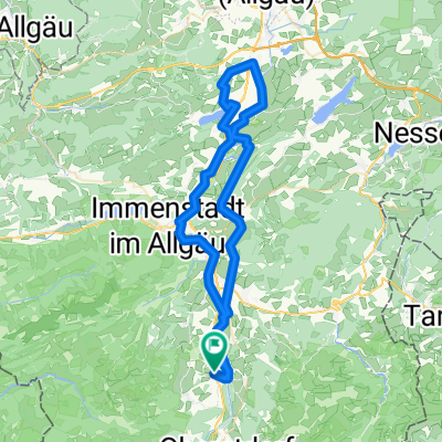
Von Schöllang aus die Oberstdorf Bikestrecke durchs Oytal
A cycling route starting in Bolsterlang, Bavaria, Germany.
Overview
About this route
From the music garden in Schöllang to Fischen
Along the left side of the Iller until the end of the gravel road
Hiking path uphill towards Schöllanger castle church (push section)
On the ridge to Rubi
Along the road to Oberstdorf
In Oberstdorf to the Schattenberg ski jump
Before the ski jump arena, turn right into Oytal
Following the road to Oytal Haus
Continue on the gravel road past Gutenaple towards Käseralpe
In the last two kilometers of climbing to Käseralpe, 300 meters of elevation gain are made - I had enough at the waterfalls just before Käseralpe...
Return to Schöllang on the hiking path via Rubi and Reichenbach
- -:--
- Duration
- 34.6 km
- Distance
- 661 m
- Ascent
- 663 m
- Descent
- ---
- Avg. speed
- ---
- Max. altitude

Continue with Bikemap
Use, edit, or download this cycling route
You would like to ride Von Schöllang aus die Oberstdorf Bikestrecke durchs Oytal or customize it for your own trip? Here is what you can do with this Bikemap route:
Free features
- Save this route as favorite or in collections
- Copy & plan your own version of this route
- Sync your route with Garmin or Wahoo
Premium features
Free trial for 3 days, or one-time payment. More about Bikemap Premium.
- Navigate this route on iOS & Android
- Export a GPX / KML file of this route
- Create your custom printout (try it for free)
- Download this route for offline navigation
Discover more Premium features.
Get Bikemap PremiumFrom our community
Other popular routes starting in Bolsterlang
 Fischen-Waltenhofen
- Distance
- 66 km
- Ascent
- 447 m
- Descent
- 452 m
- Location
- Bolsterlang, Bavaria, Germany
 Rappenalptal, Gravel
- Distance
- 46.6 km
- Ascent
- 941 m
- Descent
- 940 m
- Location
- Bolsterlang, Bavaria, Germany
 große Allgäu Runde
- Distance
- 75.5 km
- Ascent
- 1,001 m
- Descent
- 1,001 m
- Location
- Bolsterlang, Bavaria, Germany
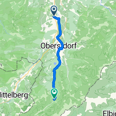
 Fischen - Oytal - Oberstdorf
- Distance
- 34.5 km
- Ascent
- 716 m
- Descent
- 717 m
- Location
- Bolsterlang, Bavaria, Germany
 Fischen-Einödsbach
- Distance
- 19.9 km
- Ascent
- 476 m
- Descent
- 158 m
- Location
- Bolsterlang, Bavaria, Germany
 Dietrichs - Gerstruben- Dietersbachalpe-dietrichs
- Distance
- 49.5 km
- Ascent
- 859 m
- Descent
- 859 m
- Location
- Bolsterlang, Bavaria, Germany
 Dietrichs-Oberstdorf-Wallraffweg-Geissalpe-Dietrichs
- Distance
- 26.2 km
- Ascent
- 612 m
- Descent
- 615 m
- Location
- Bolsterlang, Bavaria, Germany
 Radtour durch die Hörnerdörfer - Vier von Fünf sind eine runde Sache - Die Dörfer Runde
- Distance
- 27.7 km
- Ascent
- 0 m
- Descent
- 0 m
- Location
- Bolsterlang, Bavaria, Germany
Open it in the app