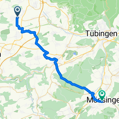
Die kürzeste Radtour der Welt - Ultimative RSV "Ovale Tour"
A cycling route starting in Unterjettingen, Baden-Wurttemberg, Germany.
Overview
About this route
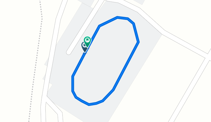
Here it rolls in the OVAL on the now-covered wooden track of RSV Öschelbronn www.RSVO.de - for better visualization, please select the 'Satellite' terrain and the highest zoom level
- -:--
- Duration
- 0.2 km
- Distance
- 0 m
- Ascent
- 0 m
- Descent
- ---
- Avg. speed
- ---
- Max. altitude
Continue with Bikemap
Use, edit, or download this cycling route
You would like to ride Die kürzeste Radtour der Welt - Ultimative RSV "Ovale Tour" or customize it for your own trip? Here is what you can do with this Bikemap route:
Free features
- Save this route as favorite or in collections
- Copy & plan your own version of this route
- Sync your route with Garmin or Wahoo
Premium features
Free trial for 3 days, or one-time payment. More about Bikemap Premium.
- Navigate this route on iOS & Android
- Export a GPX / KML file of this route
- Create your custom printout (try it for free)
- Download this route for offline navigation
Discover more Premium features.
Get Bikemap PremiumFrom our community
Other popular routes starting in Unterjettingen
- Rundreise Gäu
- Distance
- 23.6 km
- Ascent
- 229 m
- Descent
- 249 m
- Location
- Unterjettingen, Baden-Wurttemberg, Germany
- Gaeufelder Lauf 2018 (2)
- Distance
- 7.8 km
- Ascent
- 79 m
- Descent
- 78 m
- Location
- Unterjettingen, Baden-Wurttemberg, Germany
- von Gäufelden-Öschelbronn nach Mötzingen
- Distance
- 4.9 km
- Ascent
- 60 m
- Descent
- 26 m
- Location
- Unterjettingen, Baden-Wurttemberg, Germany
- Weg zur Arbeit
- Distance
- 30.1 km
- Ascent
- 308 m
- Descent
- 318 m
- Location
- Unterjettingen, Baden-Wurttemberg, Germany
- Schönbuch-Rundfahrt_Juli-2011
- Distance
- 56.1 km
- Ascent
- 597 m
- Descent
- 586 m
- Location
- Unterjettingen, Baden-Wurttemberg, Germany
- Die kürzeste Radtour der Welt - Ultimative RSV "Ovale Tour"
- Distance
- 0.2 km
- Ascent
- 0 m
- Descent
- 0 m
- Location
- Unterjettingen, Baden-Wurttemberg, Germany
- Bebenhausen
- Distance
- 52 km
- Ascent
- 496 m
- Descent
- 501 m
- Location
- Unterjettingen, Baden-Wurttemberg, Germany
- Hohennagold
- Distance
- 26.1 km
- Ascent
- 461 m
- Descent
- 461 m
- Location
- Unterjettingen, Baden-Wurttemberg, Germany
Open it in the app