

Radurlaub_2023
Obertilliach - Straning - Gasthof Michal
A cycling route starting in Obertilliach, Tyrol, Austria.
Overview
About this route
Rides on June 6, 2023
In beautiful weather, we ride along the B111 in Lesachtal. With a relaxed pace, we go downhill and gently uphill on the many ascents. Enjoying an impressive landscape, we reach Kötschach. After a break, we ride the first-class bike path R3 Gailtalradweg to Straning. A short tour to enjoy and sufficient time for sightseeing in various localities.
- -:--
- Duration
- 48.5 km
- Distance
- 747 m
- Ascent
- 1,556 m
- Descent
- ---
- Avg. speed
- 1,452 m
- Max. altitude

Part of
6 stages
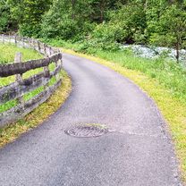
Route photos


Route quality
Waytypes & surfaces along the route
Waytypes
Cycleway
8.3 km
(17 %)
Quiet road
3.4 km
(7 %)
Surfaces
Paved
24.3 km
(50 %)
Unpaved
1.9 km
(4 %)
Asphalt
24.3 km
(50 %)
Gravel
1.9 km
(4 %)
Undefined
22.3 km
(46 %)
Continue with Bikemap
Use, edit, or download this cycling route
You would like to ride Obertilliach - Straning - Gasthof Michal or customize it for your own trip? Here is what you can do with this Bikemap route:
Free features
- Save this route as favorite or in collections
- Copy & plan your own version of this route
- Sync your route with Garmin or Wahoo
Premium features
Free trial for 3 days, or one-time payment. More about Bikemap Premium.
- Navigate this route on iOS & Android
- Export a GPX / KML file of this route
- Create your custom printout (try it for free)
- Download this route for offline navigation
Discover more Premium features.
Get Bikemap PremiumFrom our community
Other popular routes starting in Obertilliach
 2020_Obertilliach-TilliacherJoch-Almentour-Sappada
- Distance
- 43.2 km
- Ascent
- 1,278 m
- Descent
- 1,488 m
- Location
- Obertilliach, Tyrol, Austria
 Obertilliach-Porzehütte
- Distance
- 7.8 km
- Ascent
- 598 m
- Descent
- 10 m
- Location
- Obertilliach, Tyrol, Austria
 Via delle Malghe
- Distance
- 68.2 km
- Ascent
- 2,451 m
- Descent
- 2,448 m
- Location
- Obertilliach, Tyrol, Austria
 Porzerunde 3/1
- Distance
- 43.3 km
- Ascent
- 1,340 m
- Descent
- 1,537 m
- Location
- Obertilliach, Tyrol, Austria
 Obertill-Porze Hütte-Passo Silvella-Nemes-Sillian-Obertill
- Distance
- 88.3 km
- Ascent
- 3,294 m
- Descent
- 3,387 m
- Location
- Obertilliach, Tyrol, Austria
 BGD-VNZ: 07 Obertilliach - Passo del Pura (218 ***, 219 ***, 220 **, 221 ***)
- Distance
- 65.9 km
- Ascent
- 2,043 m
- Descent
- 2,052 m
- Location
- Obertilliach, Tyrol, Austria
 Radtour Wörthersee - Etappe 4
- Distance
- 134.6 km
- Ascent
- 363 m
- Descent
- 1,361 m
- Location
- Obertilliach, Tyrol, Austria
 OT- Porzehütte- Sappada retour-Tilgajoch-Porzeweg, Obertilliach nach Dorf
- Distance
- 41.3 km
- Ascent
- 1,467 m
- Descent
- 1,933 m
- Location
- Obertilliach, Tyrol, Austria
Open it in the app