

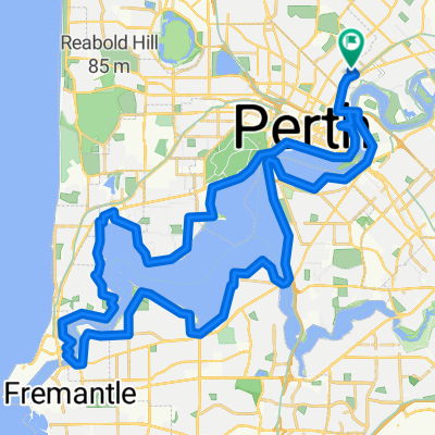
Tony Di Scerni Pathway, Mount Lawley to 41 Slade St, Bayswater
A cycling route starting in Mount Lawley, Western Australia, Australia.
Overview
About this route
- 21 min
- Duration
- 9.9 km
- Distance
- 48 m
- Ascent
- 33 m
- Descent
- 28.8 km/h
- Avg. speed
- 20 m
- Max. altitude

Route quality
Waytypes & surfaces along the route
Waytypes
Cycleway
6 km
(61 %)
Quiet road
2.2 km
(22 %)
Surfaces
Paved
3.1 km
(31 %)
Paved (undefined)
3 km
(30 %)
Asphalt
0.1 km
(1 %)
Undefined
6.8 km
(69 %)
Continue with Bikemap
Use, edit, or download this cycling route
You would like to ride Tony Di Scerni Pathway, Mount Lawley to 41 Slade St, Bayswater or customize it for your own trip? Here is what you can do with this Bikemap route:
Free features
- Save this route as favorite or in collections
- Copy & plan your own version of this route
- Sync your route with Garmin or Wahoo
Premium features
Free trial for 3 days, or one-time payment. More about Bikemap Premium.
- Navigate this route on iOS & Android
- Export a GPX / KML file of this route
- Create your custom printout (try it for free)
- Download this route for offline navigation
Discover more Premium features.
Get Bikemap PremiumFrom our community
Other popular routes starting in Mount Lawley
 Evening ride, be ready to sweat.
- Distance
- 6.3 km
- Ascent
- 46 m
- Descent
- 43 m
- Location
- Mount Lawley, Western Australia, Australia
 116 West Pde, East Perth to North Ward, North Fremantle
- Distance
- 19.8 km
- Ascent
- 164 m
- Descent
- 179 m
- Location
- Mount Lawley, Western Australia, Australia
 204–218 East Pde, Mount Lawley to 41A Slade St, Bayswater
- Distance
- 68.9 km
- Ascent
- 277 m
- Descent
- 281 m
- Location
- Mount Lawley, Western Australia, Australia
 home to work
- Distance
- 14.7 km
- Ascent
- 56 m
- Descent
- 74 m
- Location
- Mount Lawley, Western Australia, Australia
 Grosvenor Road 128, Mount Lawley to Grosvenor Road 128, Mount Lawley
- Distance
- 29.1 km
- Ascent
- 11,822 m
- Descent
- 11,821 m
- Location
- Mount Lawley, Western Australia, Australia
 popop
popop- Distance
- 28 km
- Ascent
- 130 m
- Descent
- 144 m
- Location
- Mount Lawley, Western Australia, Australia
 Blistering ride in Mt Lawley
- Distance
- 63.2 km
- Ascent
- 3 m
- Descent
- 32 m
- Location
- Mount Lawley, Western Australia, Australia
 Route to 102 Joel Terrace, Mt Lawley
- Distance
- 12.3 km
- Ascent
- 3 m
- Descent
- 9 m
- Location
- Mount Lawley, Western Australia, Australia
Open it in the app