

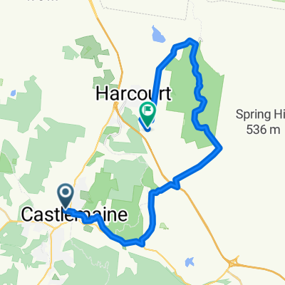
Maldon to Maryborough Extension
A cycling route starting in Castlemaine, Victoria, Australia.
Overview
About this route
- -:--
- Duration
- 58.8 km
- Distance
- 303 m
- Ascent
- 416 m
- Descent
- ---
- Avg. speed
- 388 m
- Max. altitude

Route quality
Waytypes & surfaces along the route
Waytypes
Quiet road
44.1 km
(75 %)
Road
10 km
(17 %)
Surfaces
Paved
40 km
(68 %)
Unpaved
17 km
(29 %)
Asphalt
31.7 km
(54 %)
Unpaved (undefined)
15.3 km
(26 %)
Route highlights
Points of interest along the route
Point of interest after 25.2 km
Bells Swamp - birdlife haven with water
Point of interest after 26.3 km
Grangehill Vineyard - excellent red wines - very rustic
Point of interest after 30.5 km
Hamiltons Crossing: riverside camping and picnic spot under red gums
Continue with Bikemap
Use, edit, or download this cycling route
You would like to ride Maldon to Maryborough Extension or customize it for your own trip? Here is what you can do with this Bikemap route:
Free features
- Save this route as favorite or in collections
- Copy & plan your own version of this route
- Sync your route with Garmin or Wahoo
Premium features
Free trial for 3 days, or one-time payment. More about Bikemap Premium.
- Navigate this route on iOS & Android
- Export a GPX / KML file of this route
- Create your custom printout (try it for free)
- Download this route for offline navigation
Discover more Premium features.
Get Bikemap PremiumFrom our community
Other popular routes starting in Castlemaine
 Maldon to Maryborough Extension
- Distance
- 58.8 km
- Ascent
- 303 m
- Descent
- 416 m
- Location
- Castlemaine, Victoria, Australia
 Castlemaine
- Distance
- 37.7 km
- Ascent
- 352 m
- Descent
- 353 m
- Location
- Castlemaine, Victoria, Australia
 GF6d Specimen Gully - Mt Alexander - Coliban Channel - walk
- Distance
- 14.7 km
- Ascent
- 516 m
- Descent
- 505 m
- Location
- Castlemaine, Victoria, Australia
 Castlemaine Loop (fixed)
- Distance
- 30.6 km
- Ascent
- 312 m
- Descent
- 312 m
- Location
- Castlemaine, Victoria, Australia
 Castlemaine to Mt Alexander & return
- Distance
- 47.9 km
- Ascent
- 593 m
- Descent
- 594 m
- Location
- Castlemaine, Victoria, Australia
 Giro d'Oro - Day 1 Start to Harcourt Valley
- Distance
- 19.4 km
- Ascent
- 385 m
- Descent
- 292 m
- Location
- Castlemaine, Victoria, Australia
 GF5 - Fryerstown to Castlemaine
- Distance
- 19.7 km
- Ascent
- 337 m
- Descent
- 384 m
- Location
- Castlemaine, Victoria, Australia
 Giro d'Oro Day 1 Start to Harcourt Valley - Elite
- Distance
- 31.4 km
- Ascent
- 584 m
- Descent
- 488 m
- Location
- Castlemaine, Victoria, Australia
Open it in the app