

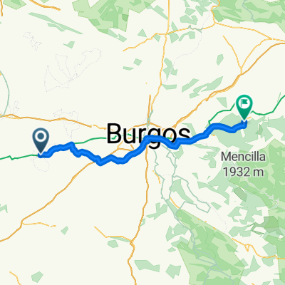
Castrojeriz - Carrión de los Condes
A cycling route starting in Villaquirán de la Puebla, Castille and León, Spain.
Overview
About this route
- -:--
- Duration
- 43.7 km
- Distance
- 350 m
- Ascent
- 326 m
- Descent
- ---
- Avg. speed
- 911 m
- Max. altitude

Route quality
Waytypes & surfaces along the route
Waytypes
Track
33.2 km
(76 %)
Quiet road
2.6 km
(6 %)
Surfaces
Paved
7 km
(16 %)
Unpaved
28.9 km
(66 %)
Gravel
25.4 km
(58 %)
Asphalt
6.6 km
(15 %)
Route highlights
Points of interest along the route
Drinking water after 24.8 km
Continue with Bikemap
Use, edit, or download this cycling route
You would like to ride Castrojeriz - Carrión de los Condes or customize it for your own trip? Here is what you can do with this Bikemap route:
Free features
- Save this route as favorite or in collections
- Copy & plan your own version of this route
- Sync your route with Garmin or Wahoo
Premium features
Free trial for 3 days, or one-time payment. More about Bikemap Premium.
- Navigate this route on iOS & Android
- Export a GPX / KML file of this route
- Create your custom printout (try it for free)
- Download this route for offline navigation
Discover more Premium features.
Get Bikemap PremiumFrom our community
Other popular routes starting in Villaquirán de la Puebla
 2006 - Auf dem Jakobsweg - 07. Tag - Castrojeriz - Calzadilla de la Cueza
- Distance
- 66.8 km
- Ascent
- 166 m
- Descent
- 111 m
- Location
- Villaquirán de la Puebla, Castille and León, Spain
 28 April 2019
- Distance
- 87.2 km
- Ascent
- 748 m
- Descent
- 600 m
- Location
- Villaquirán de la Puebla, Castille and León, Spain
 15.Jako
- Distance
- 24.7 km
- Ascent
- 227 m
- Descent
- 261 m
- Location
- Villaquirán de la Puebla, Castille and León, Spain
 07 Castrojeriz-Leon
- Distance
- 140.1 km
- Ascent
- 452 m
- Descent
- 411 m
- Location
- Villaquirán de la Puebla, Castille and León, Spain
 Castrojeriz - Carrión de los Condes
- Distance
- 43.7 km
- Ascent
- 350 m
- Descent
- 326 m
- Location
- Villaquirán de la Puebla, Castille and León, Spain
 Castrojeriz - Burgos
- Distance
- 49.8 km
- Ascent
- 504 m
- Descent
- 449 m
- Location
- Villaquirán de la Puebla, Castille and León, Spain
 Calle Cordón, 2, Castrojeriz nach Avenida del Arlanzón, 8, Burgos
- Distance
- 50 km
- Ascent
- 512 m
- Descent
- 444 m
- Location
- Villaquirán de la Puebla, Castille and León, Spain
 Camino dz.11
- Distance
- 54.7 km
- Ascent
- 218 m
- Descent
- 185 m
- Location
- Villaquirán de la Puebla, Castille and León, Spain
Open it in the app