

Redcliffe Circuit
A cycling route starting in Strathpine, Queensland, Australia.
Overview
About this route
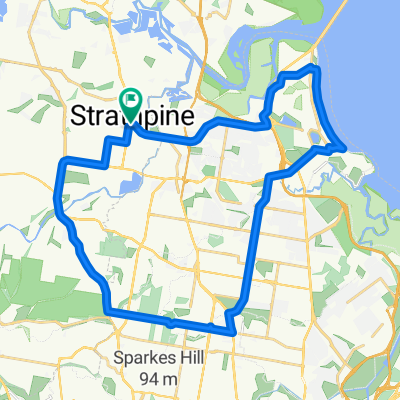
Strathpine Kallangur Mango Hill via Gympir Road and Anzac Avenue to KippaRing, along Klingner Road to Prince Edward Parade, follow shoreline through Redcliffe, Margate and Scots Point, down thru Woody Point following the shoreline again, over the Ted Smout Bridge then up the bikeway alongside the Deagon Deviation, get onto Bracken Ridge ROad and Hoyland Street and back to Strathpine. Stop and have a coffee.
- -:--
- Duration
- 43.4 km
- Distance
- 100 m
- Ascent
- 100 m
- Descent
- ---
- Avg. speed
- ---
- Max. altitude

Continue with Bikemap
Use, edit, or download this cycling route
You would like to ride Redcliffe Circuit or customize it for your own trip? Here is what you can do with this Bikemap route:
Free features
- Save this route as favorite or in collections
- Copy & plan your own version of this route
- Sync your route with Garmin or Wahoo
Premium features
Free trial for 3 days, or one-time payment. More about Bikemap Premium.
- Navigate this route on iOS & Android
- Export a GPX / KML file of this route
- Create your custom printout (try it for free)
- Download this route for offline navigation
Discover more Premium features.
Get Bikemap PremiumFrom our community
Other popular routes starting in Strathpine
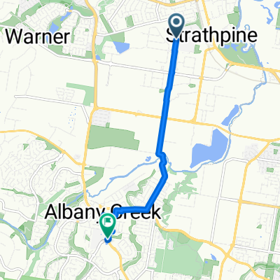
 S'pine to Samford #1
- Distance
- 21.7 km
- Ascent
- 260 m
- Descent
- 214 m
- Location
- Strathpine, Queensland, Australia
 Full Strathpine - Redcliffe Circuit
- Distance
- 50 km
- Ascent
- 125 m
- Descent
- 128 m
- Location
- Strathpine, Queensland, Australia
 Strathpine Albany Creek Chermside Sangate Circuit
- Distance
- 39.4 km
- Ascent
- 189 m
- Descent
- 189 m
- Location
- Strathpine, Queensland, Australia
 Bunya Rd Loop
- Distance
- 34.3 km
- Ascent
- 339 m
- Descent
- 290 m
- Location
- Strathpine, Queensland, Australia
 61 Affleck Avenue, Petrie to Mitchellton Avenue, Brendale
- Distance
- 9.3 km
- Ascent
- 3 m
- Descent
- 6 m
- Location
- Strathpine, Queensland, Australia
 Leitchs Rd, Brendale to Explorer Dr, Albany Creek
- Distance
- 6.5 km
- Ascent
- 48 m
- Descent
- 14 m
- Location
- Strathpine, Queensland, Australia
 HAMILTON ROAD TO RACE COURSE & HOME
- Distance
- 53.5 km
- Ascent
- 281 m
- Descent
- 289 m
- Location
- Strathpine, Queensland, Australia
 Gordons Crossing Rd W, Joyner to Haven St, Warner
- Distance
- 12.7 km
- Ascent
- 203 m
- Descent
- 191 m
- Location
- Strathpine, Queensland, Australia
Open it in the app