

Von Königsberg in den Steigerwald
A cycling route starting in Haßfurt, Bavaria, Germany.
Overview
About this route
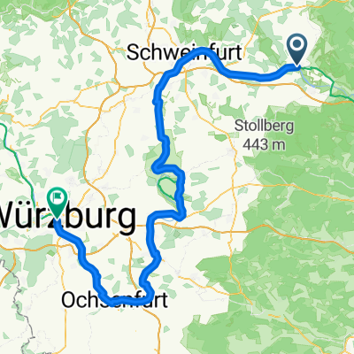
From Königsberg, take the path along Prappach to Augsfeld. Cross the Main Bridge towards Zell. In Zell, ride the cycle path through the Böhlgrund and after a few kilometers, turn left steeply uphill towards Neueschleichach. In the forest, divert towards the Marswald forest playground. From here, follow the marked cycle path and the green hiking sign (spoon). Descend left over the highway towards Sand. From Sand to Zeil, continuing towards Hohe Wann, crossing the state road HAS 10 on gravel and concrete path back to Königsberg.
- -:--
- Duration
- 43 km
- Distance
- 490 m
- Ascent
- 490 m
- Descent
- ---
- Avg. speed
- ---
- Max. altitude
Continue with Bikemap
Use, edit, or download this cycling route
You would like to ride Von Königsberg in den Steigerwald or customize it for your own trip? Here is what you can do with this Bikemap route:
Free features
- Save this route as favorite or in collections
- Copy & plan your own version of this route
- Sync your route with Garmin or Wahoo
Premium features
Free trial for 3 days, or one-time payment. More about Bikemap Premium.
- Navigate this route on iOS & Android
- Export a GPX / KML file of this route
- Create your custom printout (try it for free)
- Download this route for offline navigation
Discover more Premium features.
Get Bikemap PremiumFrom our community
Other popular routes starting in Haßfurt
 Königsberg in Bayern (40,3 km)
- Distance
- 42.2 km
- Ascent
- 617 m
- Descent
- 618 m
- Location
- Haßfurt, Bavaria, Germany
 ABR Amtsbotenritt 2012
- Distance
- 43.6 km
- Ascent
- 738 m
- Descent
- 676 m
- Location
- Haßfurt, Bavaria, Germany
 Route Hassfurt Hummelhof
- Distance
- 18.9 km
- Ascent
- 253 m
- Descent
- 140 m
- Location
- Haßfurt, Bavaria, Germany
 Haßfurt-Bamberg
- Distance
- 36.2 km
- Ascent
- 132 m
- Descent
- 119 m
- Location
- Haßfurt, Bavaria, Germany
 Von Königsberg in den Steigerwald
- Distance
- 43 km
- Ascent
- 490 m
- Descent
- 490 m
- Location
- Haßfurt, Bavaria, Germany
 Hassfurt - Volkach
- Distance
- 52.6 km
- Ascent
- 50 m
- Descent
- 74 m
- Location
- Haßfurt, Bavaria, Germany
 6. Tag Haßfurt-Bad Bocklet
- Distance
- 63 km
- Ascent
- 314 m
- Descent
- 318 m
- Location
- Haßfurt, Bavaria, Germany
 Bergrheinfeld - Wurzburg
- Distance
- 111.1 km
- Ascent
- 386 m
- Descent
- 443 m
- Location
- Haßfurt, Bavaria, Germany
Open it in the app