EV6-Linz-Constantia J7
A cycling route starting in Harta, Bács-Kiskun county, Hungary.
Overview
About this route
- -:--
- Duration
- 131.2 km
- Distance
- 181 m
- Ascent
- 187 m
- Descent
- ---
- Avg. speed
- 99 m
- Avg. speed
Route quality
Waytypes & surfaces along the route
Waytypes
Quiet road
44.4 km
(34 %)
Access road
28.8 km
(22 %)
Surfaces
Paved
89.9 km
(69 %)
Unpaved
10.6 km
(8 %)
Asphalt
81.3 km
(62 %)
Gravel
8.6 km
(7 %)
Route highlights
Points of interest along the route
Point of interest after 19.7 km
Continue with Bikemap
Use, edit, or download this cycling route
You would like to ride EV6-Linz-Constantia J7 or customize it for your own trip? Here is what you can do with this Bikemap route:
Free features
- Save this route as favorite or in collections
- Copy & plan your own version of this route
- Sync your route with Garmin or Wahoo
Premium features
Free trial for 3 days, or one-time payment. More about Bikemap Premium.
- Navigate this route on iOS & Android
- Export a GPX / KML file of this route
- Create your custom printout (try it for free)
- Download this route for offline navigation
Discover more Premium features.
Get Bikemap PremiumFrom our community
Other popular routes starting in Harta
- 2016 09 09 Harta 33 km
- Distance
- 32 km
- Ascent
- 13 m
- Descent
- 15 m
- Location
- Harta, Bács-Kiskun county, Hungary
- Eurovelo 6 - 7. nap
- Distance
- 64.7 km
- Ascent
- 35 m
- Descent
- 43 m
- Location
- Harta, Bács-Kiskun county, Hungary
- Harta-Pécsvárad
- Distance
- 105.8 km
- Ascent
- 316 m
- Descent
- 205 m
- Location
- Harta, Bács-Kiskun county, Hungary
- Easy ride in Harta
- Distance
- 3.5 km
- Ascent
- 14 m
- Descent
- 15 m
- Location
- Harta, Bács-Kiskun county, Hungary
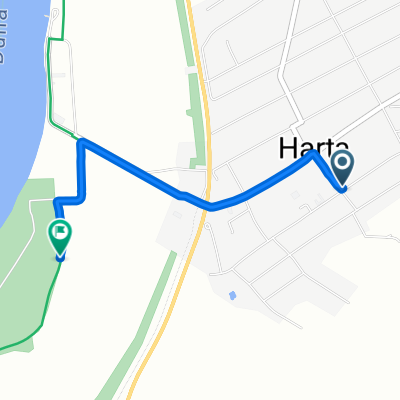
- Duna-menti II. 2. nap 2. szakasz
- Distance
- 12.7 km
- Ascent
- 8 m
- Descent
- 9 m
- Location
- Harta, Bács-Kiskun county, Hungary
- Harta-Kalocsa- Szekszárd-Pécsvárad
- Distance
- 116.7 km
- Ascent
- 370 m
- Descent
- 234 m
- Location
- Harta, Bács-Kiskun county, Hungary
- EV6-Linz-Constantia J7
- Distance
- 131.2 km
- Ascent
- 181 m
- Descent
- 187 m
- Location
- Harta, Bács-Kiskun county, Hungary
- Harta - Ráckeve
- Distance
- 66.6 km
- Ascent
- 2,236 m
- Descent
- 2,231 m
- Location
- Harta, Bács-Kiskun county, Hungary
Open it in the app