
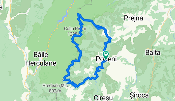
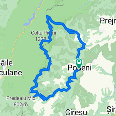
Podeni-Topolova-Culmea Munților Mehedinți-Balta Cerbului-Gornenți-Podeni
A cycling route starting in Podeni, Mehedinți County, Romania.
Overview
About this route
- -:--
- Duration
- 41.5 km
- Distance
- 1,187 m
- Ascent
- 1,186 m
- Descent
- ---
- Avg. speed
- 1,127 m
- Max. altitude

Route quality
Waytypes & surfaces along the route
Waytypes
Track
29.9 km
(72 %)
Road
9.1 km
(22 %)
Surfaces
Paved
12.4 km
(30 %)
Unpaved
29 km
(70 %)
Unpaved (undefined)
24.9 km
(60 %)
Asphalt
7.5 km
(18 %)
Continue with Bikemap
Use, edit, or download this cycling route
You would like to ride Podeni-Topolova-Culmea Munților Mehedinți-Balta Cerbului-Gornenți-Podeni or customize it for your own trip? Here is what you can do with this Bikemap route:
Free features
- Save this route as favorite or in collections
- Copy & plan your own version of this route
- Sync your route with Garmin or Wahoo
Premium features
Free trial for 3 days, or one-time payment. More about Bikemap Premium.
- Navigate this route on iOS & Android
- Export a GPX / KML file of this route
- Create your custom printout (try it for free)
- Download this route for offline navigation
Discover more Premium features.
Get Bikemap PremiumFrom our community
Other popular routes starting in Podeni
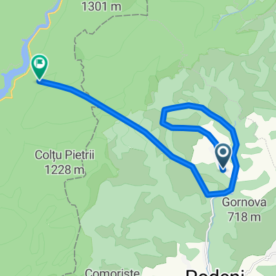 camp
camp- Distance
- 15.4 km
- Ascent
- 1,059 m
- Descent
- 1,016 m
- Location
- Podeni, Mehedinți County, Romania
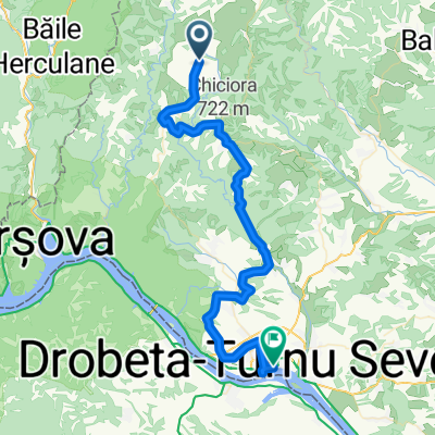 Podeni - Cladova
- Distance
- 53.4 km
- Ascent
- 893 m
- Descent
- 1,368 m
- Location
- Podeni, Mehedinți County, Romania
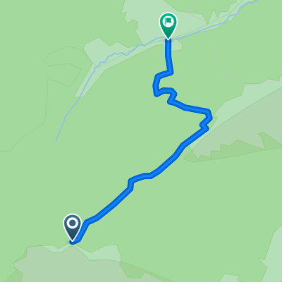 coborare Ciolanu - Valea Cosustei
- Distance
- 1.8 km
- Ascent
- 75 m
- Descent
- 390 m
- Location
- Podeni, Mehedinți County, Romania
 Podeni-Topolova-Culmea Munților Mehedinți-Balta Cerbului-Gornenți-Podeni
- Distance
- 41.5 km
- Ascent
- 1,187 m
- Descent
- 1,186 m
- Location
- Podeni, Mehedinți County, Romania
Open it in the app