

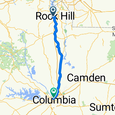
554–582 Hampton St, Rock Hill to 1998 Dave Lyle Blvd, Rock Hill
A cycling route starting in Rock Hill, South Carolina, United States.
Overview
About this route
- 25 min
- Duration
- 6.8 km
- Distance
- 36 m
- Ascent
- 56 m
- Descent
- 16.6 km/h
- Avg. speed
- 206 m
- Max. altitude
Route quality
Waytypes & surfaces along the route
Waytypes
Road
4.2 km
(62 %)
Quiet road
2 km
(29 %)
Surfaces
Paved
1.6 km
(23 %)
Asphalt
1.6 km
(23 %)
Undefined
5.2 km
(77 %)
Continue with Bikemap
Use, edit, or download this cycling route
You would like to ride 554–582 Hampton St, Rock Hill to 1998 Dave Lyle Blvd, Rock Hill or customize it for your own trip? Here is what you can do with this Bikemap route:
Free features
- Save this route as favorite or in collections
- Copy & plan your own version of this route
- Sync your route with Garmin or Wahoo
Premium features
Free trial for 3 days, or one-time payment. More about Bikemap Premium.
- Navigate this route on iOS & Android
- Export a GPX / KML file of this route
- Create your custom printout (try it for free)
- Download this route for offline navigation
Discover more Premium features.
Get Bikemap PremiumFrom our community
Other popular routes starting in Rock Hill
 little ride around the hill and beyond
- Distance
- 47.5 km
- Ascent
- 237 m
- Descent
- 240 m
- Location
- Rock Hill, South Carolina, United States
 no particular place to go
- Distance
- 32.2 km
- Ascent
- 44 m
- Descent
- 48 m
- Location
- Rock Hill, South Carolina, United States
 sdfasdfasdfasdf
- Distance
- 10.5 km
- Ascent
- 36 m
- Descent
- 75 m
- Location
- Rock Hill, South Carolina, United States
 all over the hill
- Distance
- 60.3 km
- Ascent
- 268 m
- Descent
- 286 m
- Location
- Rock Hill, South Carolina, United States
 Brownstone Drive 317, Rock Hill to North Main Street 3423, Columbia
- Distance
- 114.8 km
- Ascent
- 869 m
- Descent
- 970 m
- Location
- Rock Hill, South Carolina, United States
 spaghetti route
- Distance
- 38.6 km
- Ascent
- 29 m
- Descent
- 49 m
- Location
- Rock Hill, South Carolina, United States
 East Baskins Road 428, Rock Hill to Riverview Road 1037, Rock Hill
- Distance
- 18.3 km
- Ascent
- 7 m
- Descent
- 14 m
- Location
- Rock Hill, South Carolina, United States
 12 Mile Downtown Bike Route
- Distance
- 19.9 km
- Ascent
- 85 m
- Descent
- 85 m
- Location
- Rock Hill, South Carolina, United States
Open it in the app