

2011 Burgund
Velotour Burgund_07. Tag
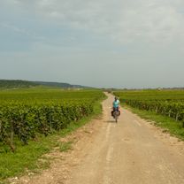
A cycling route starting in Étang-sur-Arroux, Bourgogne-Franche-Comté, France.
Overview
About this route
From Saint-Léger-sous-Beuvray to Château-Chinon:
Sights: - Bibracte - Fountain of Niki de Saint-Phalle- -:--
- Duration
- 37.2 km
- Distance
- 662 m
- Ascent
- 482 m
- Descent
- ---
- Avg. speed
- ---
- Max. altitude

Part of
2011 Burgund
10 stages
Continue with Bikemap
Use, edit, or download this cycling route
You would like to ride Velotour Burgund_07. Tag or customize it for your own trip? Here is what you can do with this Bikemap route:
Free features
- Save this route as favorite or in collections
- Copy & plan your own version of this route
- Sync your route with Garmin or Wahoo
Premium features
Free trial for 3 days, or one-time payment. More about Bikemap Premium.
- Navigate this route on iOS & Android
- Export a GPX / KML file of this route
- Create your custom printout (try it for free)
- Download this route for offline navigation
Discover more Premium features.
Get Bikemap PremiumFrom our community
Other popular routes starting in Étang-sur-Arroux
 El Parque Natural Regional del Morvan
- Distance
- 86.1 km
- Ascent
- 1,236 m
- Descent
- 1,237 m
- Location
- Étang-sur-Arroux, Bourgogne-Franche-Comté, France
 Montchenis Fachin Glux en Glenne St Prix
- Distance
- 86.2 km
- Ascent
- 957 m
- Descent
- 940 m
- Location
- Étang-sur-Arroux, Bourgogne-Franche-Comté, France
 Montchenis St Prix und zurück
- Distance
- 33.5 km
- Ascent
- 507 m
- Descent
- 508 m
- Location
- Étang-sur-Arroux, Bourgogne-Franche-Comté, France
 Velotour Burgund_07. Tag
- Distance
- 37.2 km
- Ascent
- 662 m
- Descent
- 482 m
- Location
- Étang-sur-Arroux, Bourgogne-Franche-Comté, France
 Haut Follin
- Distance
- 24.9 km
- Ascent
- 630 m
- Descent
- 630 m
- Location
- Étang-sur-Arroux, Bourgogne-Franche-Comté, France
 Haut follin
- Distance
- 25.4 km
- Ascent
- 699 m
- Descent
- 699 m
- Location
- Étang-sur-Arroux, Bourgogne-Franche-Comté, France
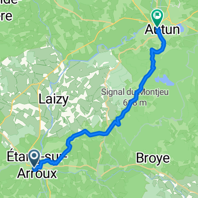 From Étang-sur-Arroux to Autun
- Distance
- 18.1 km
- Ascent
- 412 m
- Descent
- 383 m
- Location
- Étang-sur-Arroux, Bourgogne-Franche-Comté, France
 le mont beuvray
- Distance
- 65.4 km
- Ascent
- 1,208 m
- Descent
- 1,208 m
- Location
- Étang-sur-Arroux, Bourgogne-Franche-Comté, France
Open it in the app