

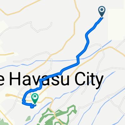
Recovered Route
A cycling route starting in Lake Havasu City, Arizona, United States.
Overview
About this route
- 1 h 27 min
- Duration
- 31 km
- Distance
- 352 m
- Ascent
- 491 m
- Descent
- 21.5 km/h
- Avg. speed
- 442 m
- Max. altitude
Route quality
Waytypes & surfaces along the route
Waytypes
Road
15.5 km
(50 %)
Quiet road
7.7 km
(25 %)
Surfaces
Paved
8.1 km
(26 %)
Asphalt
8.1 km
(26 %)
Undefined
22.9 km
(74 %)
Continue with Bikemap
Use, edit, or download this cycling route
You would like to ride Recovered Route or customize it for your own trip? Here is what you can do with this Bikemap route:
Free features
- Save this route as favorite or in collections
- Copy & plan your own version of this route
- Sync your route with Garmin or Wahoo
Premium features
Free trial for 3 days, or one-time payment. More about Bikemap Premium.
- Navigate this route on iOS & Android
- Export a GPX / KML file of this route
- Create your custom printout (try it for free)
- Download this route for offline navigation
Discover more Premium features.
Get Bikemap PremiumFrom our community
Other popular routes starting in Lake Havasu City
 Hassayampa Drive 3340, Lake Havasu City to Mercury Drive 4196, Lake Havasu City
- Distance
- 37 km
- Ascent
- 218 m
- Descent
- 180 m
- Location
- Lake Havasu City, Arizona, United States
 1795 Kiowa Ave, Lake Havasu City to 1795 Kiowa Ave, Lake Havasu City
- Distance
- 16.3 km
- Ascent
- 104 m
- Descent
- 105 m
- Location
- Lake Havasu City, Arizona, United States
 304–322 Cypress Dr, Lake Havasu City to 2131 Rover Dr, Lake Havasu City
- Distance
- 5.5 km
- Ascent
- 212 m
- Descent
- 247 m
- Location
- Lake Havasu City, Arizona, United States
 3780–3798 S Kiowa Blvd, Lake Havasu City to Magnolia Dr, Lake Havasu City
- Distance
- 7.7 km
- Ascent
- 10 m
- Descent
- 222 m
- Location
- Lake Havasu City, Arizona, United States
 Recovered Route
- Distance
- 31 km
- Ascent
- 352 m
- Descent
- 491 m
- Location
- Lake Havasu City, Arizona, United States
 Recovered Route
- Distance
- 1.3 km
- Ascent
- 36 m
- Descent
- 102 m
- Location
- Lake Havasu City, Arizona, United States
 1150 McCulloch Blvd S, Lake Havasu City to 1150 McCulloch Blvd S, Lake Havasu City
- Distance
- 5.9 km
- Ascent
- 28 m
- Descent
- 27 m
- Location
- Lake Havasu City, Arizona, United States
 Tony Hawk
- Distance
- 5.7 km
- Ascent
- 59 m
- Descent
- 60 m
- Location
- Lake Havasu City, Arizona, United States
Open it in the app