

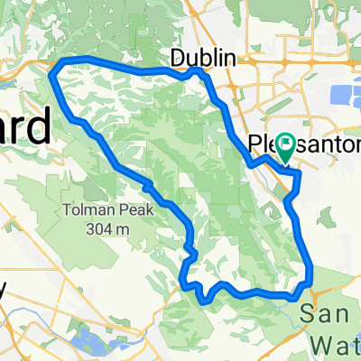
Pleasanton to highway 130 via Calaveras Reservior
A cycling route starting in Pleasanton, California, United States of America.
Overview
About this route
Pleasanton to Highway 130 via Calaveras Reservoir. First Stage of Mt. Hamilton Centur
- -:--
- Duration
- 45.2 km
- Distance
- 477 m
- Ascent
- 453 m
- Descent
- ---
- Avg. speed
- ---
- Avg. speed

Route quality
Waytypes & surfaces along the route
Waytypes
Road
26.9 km
(60 %)
Busy road
16.3 km
(36 %)
Surfaces
Paved
13.1 km
(29 %)
Asphalt
12.7 km
(28 %)
Concrete
0.4 km
(<1 %)
Undefined
32.2 km
(71 %)
Continue with Bikemap
Use, edit, or download this cycling route
You would like to ride Pleasanton to highway 130 via Calaveras Reservior or customize it for your own trip? Here is what you can do with this Bikemap route:
Free features
- Save this route as favorite or in collections
- Copy & plan your own version of this route
- Sync your route with Garmin or Wahoo
Premium features
Free trial for 3 days, or one-time payment. More about Bikemap Premium.
- Navigate this route on iOS & Android
- Export a GPX / KML file of this route
- Create your custom printout (try it for free)
- Download this route for offline navigation
Discover more Premium features.
Get Bikemap PremiumFrom our community
Other popular routes starting in Pleasanton
 High-speed route in Pleasanton
- Distance
- 68.3 km
- Ascent
- 431 m
- Descent
- 438 m
- Location
- Pleasanton, California, United States of America
 5813 Arthur Dr, Pleasanton to 5825 Arthur Dr, Pleasanton
- Distance
- 48.4 km
- Ascent
- 513 m
- Descent
- 522 m
- Location
- Pleasanton, California, United States of America
 Palomares
- Distance
- 47.9 km
- Ascent
- 494 m
- Descent
- 491 m
- Location
- Pleasanton, California, United States of America
 Pleasanton Ridge
- Distance
- 10.7 km
- Ascent
- 416 m
- Descent
- 417 m
- Location
- Pleasanton, California, United States of America
 Blistering ride in Pleasanton
- Distance
- 63.4 km
- Ascent
- 255 m
- Descent
- 266 m
- Location
- Pleasanton, California, United States of America
 Iron Hourse Trail - Bollinger Canyon Road
- Distance
- 30.4 km
- Ascent
- 119 m
- Descent
- 120 m
- Location
- Pleasanton, California, United States of America
 Fast ride in Pleasanton
- Distance
- 39 km
- Ascent
- 151 m
- Descent
- 157 m
- Location
- Pleasanton, California, United States of America
 Pleasanton Ridge Climb
- Distance
- 10.7 km
- Ascent
- 470 m
- Descent
- 232 m
- Location
- Pleasanton, California, United States of America
Open it in the app