

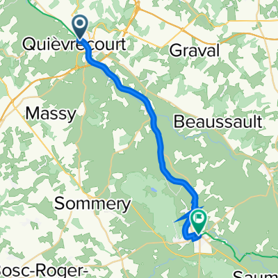
Neufchatel-en-Bray to Beauvais
A cycling route starting in Neufchâtel-en-Bray, Normandy, France.
Overview
About this route
Cycle Path along the river
- -:--
- Duration
- 77.5 km
- Distance
- 463 m
- Ascent
- 507 m
- Descent
- ---
- Avg. speed
- 193 m
- Max. altitude

Route quality
Waytypes & surfaces along the route
Waytypes
Path
43.4 km
(56 %)
Road
15.5 km
(20 %)
Surfaces
Paved
52.7 km
(68 %)
Asphalt
51.2 km
(66 %)
Paved (undefined)
1.6 km
(2 %)
Undefined
24.8 km
(32 %)
Continue with Bikemap
Use, edit, or download this cycling route
You would like to ride Neufchatel-en-Bray to Beauvais or customize it for your own trip? Here is what you can do with this Bikemap route:
Free features
- Save this route as favorite or in collections
- Copy & plan your own version of this route
- Sync your route with Garmin or Wahoo
Premium features
Free trial for 3 days, or one-time payment. More about Bikemap Premium.
- Navigate this route on iOS & Android
- Export a GPX / KML file of this route
- Create your custom printout (try it for free)
- Download this route for offline navigation
Discover more Premium features.
Get Bikemap PremiumFrom our community
Other popular routes starting in Neufchâtel-en-Bray
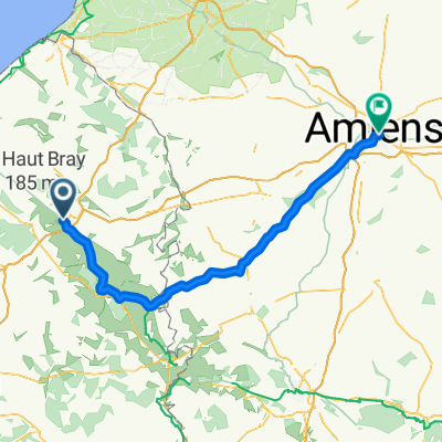 Neufchâtel-en-Bray to Amiens
- Distance
- 95.9 km
- Ascent
- 722 m
- Descent
- 761 m
- Location
- Neufchâtel-en-Bray, Normandy, France
 Neufchâtel-en-Bray to 2–4 Place de la République, Forges-les-Eaux
- Distance
- 19.7 km
- Ascent
- 154 m
- Descent
- 69 m
- Location
- Neufchâtel-en-Bray, Normandy, France
 day 2 - Le Mont Florentin
- Distance
- 76 km
- Ascent
- 625 m
- Descent
- 490 m
- Location
- Neufchâtel-en-Bray, Normandy, France
 L'Avenue Verte - Stage 3
- Distance
- 16.2 km
- Ascent
- 45 m
- Descent
- 85 m
- Location
- Neufchâtel-en-Bray, Normandy, France
 Rue du Baron d'Haussez, Neufchâtel-en-Bray to Rue des Argilières, Gisors
- Distance
- 79.6 km
- Ascent
- 581 m
- Descent
- 620 m
- Location
- Neufchâtel-en-Bray, Normandy, France
 Normandie 1
- Distance
- 38.3 km
- Ascent
- 170 m
- Descent
- 218 m
- Location
- Neufchâtel-en-Bray, Normandy, France
 Normandy Cycling 2025
- Distance
- 443.1 km
- Ascent
- 3,311 m
- Descent
- 3,397 m
- Location
- Neufchâtel-en-Bray, Normandy, France
 Neufchâtel-en-Bray to 2 Chemin de Trefforest, Mesnil-Mauger
- Distance
- 12.2 km
- Ascent
- 82 m
- Descent
- 16 m
- Location
- Neufchâtel-en-Bray, Normandy, France
Open it in the app