Le rendez-Vous
- 62 km
- 57 m
- 57 m
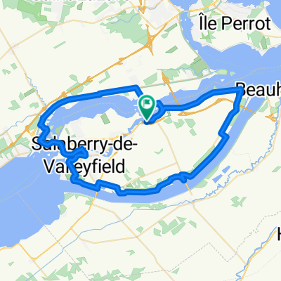
- Les Cèdres, Quebec, Canada
A cycling route starting in Les Cèdres, Quebec, Canada.
Overview
Starting in Les Cedres,heading to Coteau du Lac then Valleyfield. We would need an escort across the bridge. From the bridge back to Les Cedres it is 38.2 kms. That is a total of 105 kms.
created this 2 years ago
Route quality
Cycleway
43 km
(64 %)
Road
6.7 km
(10 %)
Paved
53 km
(79 %)
Unpaved
1.3 km
(2 %)
Asphalt
36.9 km
(55 %)
Paved (undefined)
14.8 km
(22 %)
Continue with Bikemap
You would like to ride 100 km challenge for end of May or customize it for your own trip? Here is what you can do with this Bikemap route:
Free trial for 3 days, or one-time payment. More about Bikemap Premium.
Discover more Premium features.
Get Bikemap PremiumFrom our community
Open it in the app