

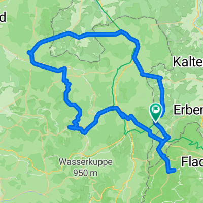
Oberhoftour 4-Tagesvariante 2. Eisenacher Hs - Oberhof, entschärft
A cycling route starting in Frankenheim, Free State of Thuringia, Germany.
Overview
About this route
- -:--
- Duration
- 65.3 km
- Distance
- 969 m
- Ascent
- 1,085 m
- Descent
- ---
- Avg. speed
- 802 m
- Max. altitude

Route quality
Waytypes & surfaces along the route
Waytypes
Track
37.8 km
(58 %)
Busy road
9.2 km
(14 %)
Surfaces
Paved
18.8 km
(29 %)
Unpaved
35.4 km
(54 %)
Gravel
21.4 km
(33 %)
Asphalt
17.6 km
(27 %)
Continue with Bikemap
Use, edit, or download this cycling route
You would like to ride Oberhoftour 4-Tagesvariante 2. Eisenacher Hs - Oberhof, entschärft or customize it for your own trip? Here is what you can do with this Bikemap route:
Free features
- Save this route as favorite or in collections
- Copy & plan your own version of this route
- Sync your route with Garmin or Wahoo
Premium features
Free trial for 3 days, or one-time payment. More about Bikemap Premium.
- Navigate this route on iOS & Android
- Export a GPX / KML file of this route
- Create your custom printout (try it for free)
- Download this route for offline navigation
Discover more Premium features.
Get Bikemap PremiumFrom our community
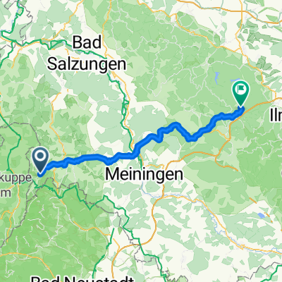
Other popular routes starting in Frankenheim
 Route nach Schwarzes Moor 1, Fladungen
- Distance
- 5.4 km
- Ascent
- 144 m
- Descent
- 115 m
- Location
- Frankenheim, Free State of Thuringia, Germany
 Angerweg 15, Frankenheim/Rhön nach Dermbach, Regelschule
- Distance
- 26.8 km
- Ascent
- 120 m
- Descent
- 499 m
- Location
- Frankenheim, Free State of Thuringia, Germany
 Sommertour 2021 Hessen-NRW
- Distance
- 374.5 km
- Ascent
- 3,529 m
- Descent
- 4,269 m
- Location
- Frankenheim, Free State of Thuringia, Germany
 Zum Dreiländereck
- Distance
- 72.7 km
- Ascent
- 650 m
- Descent
- 1,023 m
- Location
- Frankenheim, Free State of Thuringia, Germany
 rhön19
- Distance
- 43.2 km
- Ascent
- 707 m
- Descent
- 701 m
- Location
- Frankenheim, Free State of Thuringia, Germany
 Test Röhn2
- Distance
- 52.2 km
- Ascent
- 379 m
- Descent
- 748 m
- Location
- Frankenheim, Free State of Thuringia, Germany
 Angerweg 15, Frankenheim/Rhön nach Heinrich-von-Bibra-Platz 16, Fulda
- Distance
- 38.4 km
- Ascent
- 458 m
- Descent
- 925 m
- Location
- Frankenheim, Free State of Thuringia, Germany
 Oberhoftour 4-Tagesvariante 2. Eisenacher Hs - Oberhof, entschärft
- Distance
- 65.3 km
- Ascent
- 969 m
- Descent
- 1,085 m
- Location
- Frankenheim, Free State of Thuringia, Germany
Open it in the app