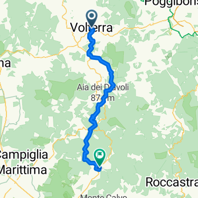
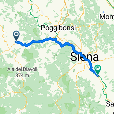
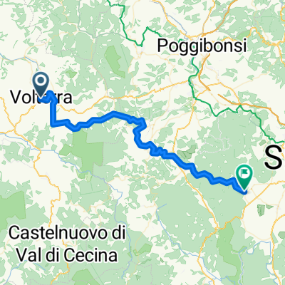
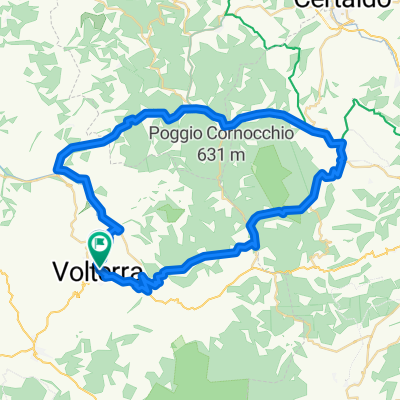
Via Giacomo Matteotti, Volterra à Piazza Umberto I, San Vincenzo
- 72.8 km
- 1,046 m
- 1,577 m
- Volterra, Tuscany, Italy
A cycling route starting in Volterra, Tuscany, Italy.
Overview
Food options at Castel San Gimignano 15km or San Gimignano 30km Colle di Val d'Elsa at 41km Monteriggioni 55km for lunch
created this 2 years ago
Route quality
Quiet road
8.6 km
(12 %)
Track
5 km
(7 %)
Paved
60.1 km
(84 %)
Unpaved
7.9 km
(11 %)
Asphalt
59.4 km
(83 %)
Unpaved (undefined)
2.9 km
(4 %)
Route highlights
Appartamenti Villa Mascagni
Torre di Montemiccioli The Montemiccioli tower was an important defensive bulwark in the area in the Middle Ages. The structure is presented in the form of ruins, in a serious state of abandonment, and has suffered massive collapses over the last 100 years
Le Gemelle Supermarket opens 0730 Sunday
Bar Sulcis opens 0900 Sunday
Punto Panoramico
Parco della Rocca Ruined medieval fortress on a hilltop with views of rolling Tuscan countryside, popular at sunset.
Piazza del Duomo
Piazza della Cisterna
Punto Panoramico
Torre e Casa Campatelli
Museo Della Tortura E Della Pena Di Morte
Porta San Giovanni
cact_us bags Handbags shop ?closed Sunday :(
Palazzo Campana
Il Baluardo Scenic spot
Torretta della Bonifica The ruins of the ancient tower testify to the reclamation works carried out in the Middle Ages by the monks of the nearby abbadia island, to drain and make fertile soil what was formerly a lake extension and swampy territory called Canneto. Some very close finds, attributed to the Etruscan period, suggest that the first reclamation works date back to even earlier periods. The structure was used both for the construction and for the maintenance and monitoring of the underlying extraction channel dug in the tunnel, which still collects and disposes of water today.
Mura di Monteriggioni
Porta Fiorentina
Osteria Antico Travaglio 12 - 3.50 Sunday
Porta Franca (o Romea)

Panoramic View
Palazzo del Papa Suites
Continue with Bikemap
You would like to ride Sard 18. Volterra to Siena or customize it for your own trip? Here is what you can do with this Bikemap route:
Free trial for 3 days, or one-time payment. More about Bikemap Premium.
Discover more Premium features.
Get Bikemap PremiumFrom our community
Open it in the app