

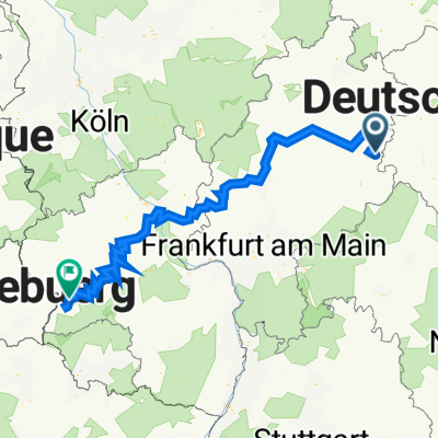
Trier
A cycling route starting in Rasdorf, Hesse, Germany.
Overview
About this route
- -:--
- Duration
- 522.3 km
- Distance
- 3,805 m
- Ascent
- 3,980 m
- Descent
- ---
- Avg. speed
- 447 m
- Max. altitude

Route quality
Waytypes & surfaces along the route
Waytypes
Path
177.6 km
(34 %)
Track
135.8 km
(26 %)
Surfaces
Paved
464.8 km
(89 %)
Unpaved
15.7 km
(3 %)
Asphalt
443.9 km
(85 %)
Paved (undefined)
15.7 km
(3 %)
Route highlights
Points of interest along the route
Point of interest after 65.6 km
Point of interest after 126.2 km
Accommodation after 201.1 km
Point of interest after 266.4 km
Point of interest after 327 km
Point of interest after 398.9 km
Point of interest after 470.4 km
Point of interest after 512.3 km
Point of interest after 513.2 km
Point of interest after 522.3 km
Continue with Bikemap
Use, edit, or download this cycling route
You would like to ride Trier or customize it for your own trip? Here is what you can do with this Bikemap route:
Free features
- Save this route as favorite or in collections
- Copy & plan your own version of this route
- Split it into stages to create a multi-day tour
- Sync your route with Garmin or Wahoo
Premium features
Free trial for 3 days, or one-time payment. More about Bikemap Premium.
- Navigate this route on iOS & Android
- Export a GPX / KML file of this route
- Create your custom printout (try it for free)
- Download this route for offline navigation
Discover more Premium features.
Get Bikemap PremiumFrom our community
Other popular routes starting in Rasdorf
 Am Anger 15, Rasdorf nach Karl-Marx-Platz 65, Oechsen
- Distance
- 16.1 km
- Ascent
- 291 m
- Descent
- 221 m
- Location
- Rasdorf, Hesse, Germany
 05. Eiserner Vorhang
- Distance
- 101 km
- Ascent
- 965 m
- Descent
- 1,009 m
- Location
- Rasdorf, Hesse, Germany
 Route nach Linkbergstraße, Hünfeld
- Distance
- 9 km
- Ascent
- 200 m
- Descent
- 251 m
- Location
- Rasdorf, Hesse, Germany
 2015 Kegelspiel Radweg,Großentaft-Wenigentaft
- Distance
- 15.9 km
- Ascent
- 96 m
- Descent
- 96 m
- Location
- Rasdorf, Hesse, Germany
 FF Rundfahrt Rasdorf - Großentaft - Setzelbach
- Distance
- 26 km
- Ascent
- 295 m
- Descent
- 297 m
- Location
- Rasdorf, Hesse, Germany
 Trier
Trier- Distance
- 522.3 km
- Ascent
- 3,805 m
- Descent
- 3,980 m
- Location
- Rasdorf, Hesse, Germany
 grensovergang Geisa Thüringen
- Distance
- 6.7 km
- Ascent
- 162 m
- Descent
- 164 m
- Location
- Rasdorf, Hesse, Germany
 Unnamed Road, Rasdorf nach Hartmannsweg 4, Rasdorf
- Distance
- 2.1 km
- Ascent
- 26 m
- Descent
- 54 m
- Location
- Rasdorf, Hesse, Germany
Open it in the app