

Untersee
A cycling route starting in Daisendorf, Baden-Wurttemberg, Germany.
Overview
About this route
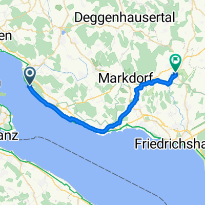
Daisendorf - Wolmatingen - Reichenau - Radolfzell - Horn - Stein am Rhein - Steckborn - Konstanz
too many campsites, marinas, and other private lands, especially on the Swiss side, which force detours away from the lake.
many beautiful swimming beaches with lovely meadows, mostly public.
top late summer weather on September 10, 2011.
note the alternative route from the ferry to Daisendorf!
- -:--
- Duration
- 95.1 km
- Distance
- 314 m
- Ascent
- 315 m
- Descent
- ---
- Avg. speed
- ---
- Max. altitude
Route quality
Waytypes & surfaces along the route
Waytypes
Path
25.7 km
(27 %)
Quiet road
22.8 km
(24 %)
Surfaces
Paved
74.2 km
(78 %)
Unpaved
11.4 km
(12 %)
Asphalt
72.3 km
(76 %)
Gravel
5.7 km
(6 %)
Route highlights
Points of interest along the route
Point of interest after 43.8 km
mini-cappucino, gibts nur mit sahne, sonst milchkaffee, und das ganze für 2,80 im paradies
Point of interest after 78.1 km
eiskaffee im Gottlieber, himmlisch lecker, sündhaft teuer. die schweiz ist zur zeit noch teurer als sonst schon.
Continue with Bikemap
Use, edit, or download this cycling route
You would like to ride Untersee or customize it for your own trip? Here is what you can do with this Bikemap route:
Free features
- Save this route as favorite or in collections
- Copy & plan your own version of this route
- Split it into stages to create a multi-day tour
- Sync your route with Garmin or Wahoo
Premium features
Free trial for 3 days, or one-time payment. More about Bikemap Premium.
- Navigate this route on iOS & Android
- Export a GPX / KML file of this route
- Create your custom printout (try it for free)
- Download this route for offline navigation
Discover more Premium features.
Get Bikemap PremiumFrom our community
Other popular routes starting in Daisendorf
 2012-07-14_FN_Nostalgie
- Distance
- 75.7 km
- Ascent
- 597 m
- Descent
- 597 m
- Location
- Daisendorf, Baden-Wurttemberg, Germany
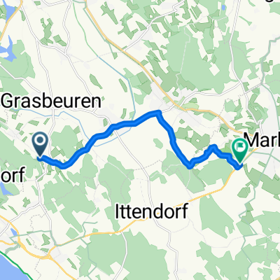 Daisendorf - Markdorf
- Distance
- 8.5 km
- Ascent
- 37 m
- Descent
- 79 m
- Location
- Daisendorf, Baden-Wurttemberg, Germany
 Bergstraße nach Augustin-Bea-Straße
- Distance
- 25.8 km
- Ascent
- 144 m
- Descent
- 121 m
- Location
- Daisendorf, Baden-Wurttemberg, Germany
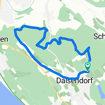 Shadow 1
- Distance
- 7.6 km
- Ascent
- 150 m
- Descent
- 149 m
- Location
- Daisendorf, Baden-Wurttemberg, Germany
 Untersee
- Distance
- 95.1 km
- Ascent
- 314 m
- Descent
- 315 m
- Location
- Daisendorf, Baden-Wurttemberg, Germany
 10.06.09 Unteruhldingen-Überlingen, kl. Rundfahrt
- Distance
- 28.2 km
- Ascent
- 142 m
- Descent
- 143 m
- Location
- Daisendorf, Baden-Wurttemberg, Germany
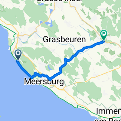 Obere Roggenlehen 4A nach Salemer Straße
- Distance
- 12.2 km
- Ascent
- 196 m
- Descent
- 187 m
- Location
- Daisendorf, Baden-Wurttemberg, Germany
 10.06.09 Unteruhldingen-Überlingen, kl. Rundfahrt
- Distance
- 28.2 km
- Ascent
- 141 m
- Descent
- 145 m
- Location
- Daisendorf, Baden-Wurttemberg, Germany
Open it in the app