

Wellesbourne / Oxhill / Ettington
A cycling route starting in Wellesbourne Mountford, England, United Kingdom.
Overview
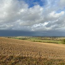
About this route
Lunch at The Chequers in Ettington after 23 miles. Then 5 miles home.
- -:--
- Duration
- 45.8 km
- Distance
- 289 m
- Ascent
- 292 m
- Descent
- ---
- Avg. speed
- 129 m
- Max. altitude

Route quality
Waytypes & surfaces along the route
Waytypes
Road
19.7 km
(43 %)
Quiet road
19.7 km
(43 %)
Undefined
6.4 km
(14 %)
Surfaces
Paved
16.5 km
(36 %)
Asphalt
16.5 km
(36 %)
Undefined
29.3 km
(64 %)
Continue with Bikemap
Use, edit, or download this cycling route
You would like to ride Wellesbourne / Oxhill / Ettington or customize it for your own trip? Here is what you can do with this Bikemap route:
Free features
- Save this route as favorite or in collections
- Copy & plan your own version of this route
- Sync your route with Garmin or Wahoo
Premium features
Free trial for 3 days, or one-time payment. More about Bikemap Premium.
- Navigate this route on iOS & Android
- Export a GPX / KML file of this route
- Create your custom printout (try it for free)
- Download this route for offline navigation
Discover more Premium features.
Get Bikemap PremiumFrom our community
Other popular routes starting in Wellesbourne Mountford
 Kineton to Northend (Lost Pug) Loop
- Distance
- 25.7 km
- Ascent
- 168 m
- Descent
- 167 m
- Location
- Wellesbourne Mountford, England, United Kingdom
 20 Church St, Stratford-on-Avon to The Old Bakehouse, Shipston Road, Warwick
- Distance
- 17 km
- Ascent
- 128 m
- Descent
- 60 m
- Location
- Wellesbourne Mountford, England, United Kingdom
 Extended Tysoe via Honington
- Distance
- 35.4 km
- Ascent
- 359 m
- Descent
- 359 m
- Location
- Wellesbourne Mountford, England, United Kingdom
 Kineton - Welford loop
- Distance
- 68.1 km
- Ascent
- 275 m
- Descent
- 275 m
- Location
- Wellesbourne Mountford, England, United Kingdom
 Rawlinson Bracket 2015 - The First Bit
- Distance
- 43.7 km
- Ascent
- 365 m
- Descent
- 253 m
- Location
- Wellesbourne Mountford, England, United Kingdom
 chipping camden loop
- Distance
- 58 km
- Ascent
- 387 m
- Descent
- 389 m
- Location
- Wellesbourne Mountford, England, United Kingdom
 Loxley Charlecote Circular Route
- Distance
- 17.9 km
- Ascent
- 104 m
- Descent
- 96 m
- Location
- Wellesbourne Mountford, England, United Kingdom
 3 Grantham Road, Warwick to 3 Grantham Road, Warwick
- Distance
- 12.1 km
- Ascent
- 35 m
- Descent
- 32 m
- Location
- Wellesbourne Mountford, England, United Kingdom
Open it in the app