Wurz-Pressath-Neustadt-Wurz
- 55.6 km
- 522 m
- 515 m
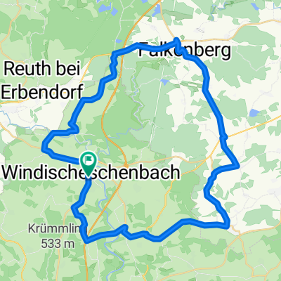
- Windischeschenbach, Bavaria, Germany
A cycling route starting in Windischeschenbach, Bavaria, Germany.
Overview
WE-Altenstadt-New: Meerbodenreuth-Parkstein-Hammerles-Wollau-Erbendorf (VP)-Friedenfels-Poppenreuth-Pechbrunn-Konnersreuth-Groppenham-New: Münchnreuth-Waldsassen-OD Waldsassen-Sibylenbad (VP)-New: Altmugl-Mähring-Griesbach-Asch-Bernau-Hohenthann-Silberhütte-Flossenbürg-Waldkirch-Georgenberg (VP)-Neuenhammer-Waldthurn-New: Floß-Störnstein via Spange on B15 and follow until the turnoff for Falkenberg-previous route Distance of refreshment stops:
created this 14 years ago
Route quality
Road
39.8 km
(17 %)
Quiet road
37.4 km
(16 %)
Paved
215.3 km
(92 %)
Unpaved
2.3 km
(1 %)
Asphalt
215.3 km
(92 %)
Gravel
2.3 km
(1 %)
Undefined
16.4 km
(7 %)
Route highlights
1. Verpflegung nach Km 43
2. VP Distanz 73 km
Getränke Distanz 34 km
3. VP Distanz 44 km
4. VP Distanz 25 km
Continue with Bikemap
You would like to ride Entwurf A Strecke Pano 2015 or customize it for your own trip? Here is what you can do with this Bikemap route:
Free trial for 3 days, or one-time payment. More about Bikemap Premium.
Discover more Premium features.
Get Bikemap PremiumFrom our community
Open it in the app