15 Princes Street, Burnie to 3–5 West Mooreville Rd, Park Grove
A cycling route starting in Burnie, Tasmania, Australia.
Overview
About this route
- 16 min
- Duration
- 3.2 km
- Distance
- 122 m
- Ascent
- 51 m
- Descent
- 12.2 km/h
- Avg. speed
- 113 m
- Avg. speed
Route quality
Waytypes & surfaces along the route
Waytypes
Quiet road
1.6 km
(52 %)
Busy road
1.5 km
(48 %)
Undefined
0 km
(<1 %)
Surfaces
Paved
3.2 km
(100 %)
Asphalt
3.1 km
(98 %)
Paved (undefined)
0.1 km
(2 %)
Continue with Bikemap
Use, edit, or download this cycling route
You would like to ride 15 Princes Street, Burnie to 3–5 West Mooreville Rd, Park Grove or customize it for your own trip? Here is what you can do with this Bikemap route:
Free features
- Save this route as favorite or in collections
- Copy & plan your own version of this route
- Sync your route with Garmin or Wahoo
Premium features
Free trial for 3 days, or one-time payment. More about Bikemap Premium.
- Navigate this route on iOS & Android
- Export a GPX / KML file of this route
- Create your custom printout (try it for free)
- Download this route for offline navigation
Discover more Premium features.
Get Bikemap PremiumFrom our community
Other popular routes starting in Burnie
- Recovered Route
- Distance
- 1.7 km
- Ascent
- 16 m
- Descent
- 39 m
- Location
- Burnie, Tasmania, Australia
- 7 Toorak Court, Parklands to 7 Toorak Court, Parklands
- Distance
- 31.9 km
- Ascent
- 1,048 m
- Descent
- 1,051 m
- Location
- Burnie, Tasmania, Australia
- 18 Princes Street, Burnie to 51 Curraghmore Avenue, Park Grove
- Distance
- 2.4 km
- Ascent
- 79 m
- Descent
- 16 m
- Location
- Burnie, Tasmania, Australia
- 1 Brickwell Street, South Burnie to 2 North Tce, Burnie
- Distance
- 1.6 km
- Ascent
- 10 m
- Descent
- 16 m
- Location
- Burnie, Tasmania, Australia
- 51 Curraghmore Avenue, Park Grove to 15 Princes Street, Burnie
- Distance
- 2.9 km
- Ascent
- 131 m
- Descent
- 190 m
- Location
- Burnie, Tasmania, Australia
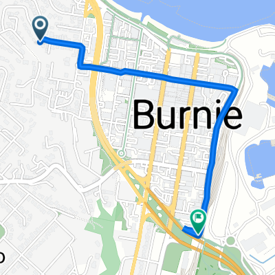
- 18 Princes Street, Burnie to Montello
- Distance
- 2 km
- Ascent
- 70 m
- Descent
- 23 m
- Location
- Burnie, Tasmania, Australia
- Wilson Street 55, Burnie to Port Road 288-290, Boat Harbour Beach
- Distance
- 33.3 km
- Ascent
- 303 m
- Descent
- 302 m
- Location
- Burnie, Tasmania, Australia
- 54 Arthur Street, Somerset to 54 Arthur Street, Somerset
- Distance
- 8.8 km
- Ascent
- 49 m
- Descent
- 91 m
- Location
- Burnie, Tasmania, Australia
Open it in the app