

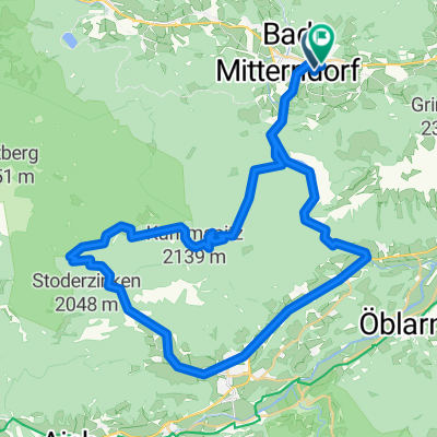
Tauplitzalm - Grundlsee - Bad Mitterndorf - Tauplitzalm
A cycling route starting in Tauplitz, Styria, Austria.
Overview
About this route
You have to carry bike between 3 and 4 km - very bad path (even for walking).
Very nice part is from 13km.
From 15km only asphalt road.
- -:--
- Duration
- 50.9 km
- Distance
- 1,271 m
- Ascent
- 1,271 m
- Descent
- ---
- Avg. speed
- ---
- Max. altitude

Continue with Bikemap
Use, edit, or download this cycling route
You would like to ride Tauplitzalm - Grundlsee - Bad Mitterndorf - Tauplitzalm or customize it for your own trip? Here is what you can do with this Bikemap route:
Free features
- Save this route as favorite or in collections
- Copy & plan your own version of this route
- Sync your route with Garmin or Wahoo
Premium features
Free trial for 3 days, or one-time payment. More about Bikemap Premium.
- Navigate this route on iOS & Android
- Export a GPX / KML file of this route
- Create your custom printout (try it for free)
- Download this route for offline navigation
Discover more Premium features.
Get Bikemap PremiumFrom our community
Other popular routes starting in Tauplitz
 Tauplitz
- Distance
- 29.2 km
- Ascent
- 715 m
- Descent
- 1,565 m
- Location
- Tauplitz, Styria, Austria
 Tauplitzalm - Grundlsee - Bad Mitterndorf - Tauplitzalm
- Distance
- 50.9 km
- Ascent
- 1,271 m
- Descent
- 1,271 m
- Location
- Tauplitz, Styria, Austria
 Bad Mitterndorf
- Distance
- 47.8 km
- Ascent
- 939 m
- Descent
- 936 m
- Location
- Tauplitz, Styria, Austria
 Okolo Ödensee
- Distance
- 43.7 km
- Ascent
- 643 m
- Descent
- 643 m
- Location
- Tauplitz, Styria, Austria
 Tauplitzalm
- Distance
- 25.1 km
- Ascent
- 878 m
- Descent
- 878 m
- Location
- Tauplitz, Styria, Austria
 Bad Mittendorf_VeihbergalmGROBMING-Salzastausee_BM_45_990
- Distance
- 45.3 km
- Ascent
- 958 m
- Descent
- 958 m
- Location
- Tauplitz, Styria, Austria
 Grundlsee
- Distance
- 60 km
- Ascent
- 763 m
- Descent
- 763 m
- Location
- Tauplitz, Styria, Austria
 Tauplitzalm -> Tauplitz
- Distance
- 15.9 km
- Ascent
- 260 m
- Descent
- 984 m
- Location
- Tauplitz, Styria, Austria
Open it in the app