

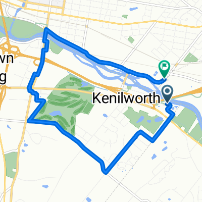
91 Wil-Be Dr, Pottstown to 1495 E High St, Pottstown
A cycling route starting in Kenilworth, Pennsylvania, United States.
Overview
About this route
- 36 min
- Duration
- 9.3 km
- Distance
- 68 m
- Ascent
- 71 m
- Descent
- 15.7 km/h
- Avg. speed
- 88 m
- Max. altitude

Route quality
Waytypes & surfaces along the route
Waytypes
Quiet road
3.9 km
(42 %)
Busy road
2.7 km
(29 %)
Surfaces
Paved
2.2 km
(24 %)
Asphalt
2.2 km
(24 %)
Undefined
7.1 km
(76 %)
Continue with Bikemap
Use, edit, or download this cycling route
You would like to ride 91 Wil-Be Dr, Pottstown to 1495 E High St, Pottstown or customize it for your own trip? Here is what you can do with this Bikemap route:
Free features
- Save this route as favorite or in collections
- Copy & plan your own version of this route
- Sync your route with Garmin or Wahoo
Premium features
Free trial for 3 days, or one-time payment. More about Bikemap Premium.
- Navigate this route on iOS & Android
- Export a GPX / KML file of this route
- Create your custom printout (try it for free)
- Download this route for offline navigation
Discover more Premium features.
Get Bikemap PremiumFrom our community
Other popular routes starting in Kenilworth
 Full SRT, one-way
- Distance
- 64.1 km
- Ascent
- 442 m
- Descent
- 481 m
- Location
- Kenilworth, Pennsylvania, United States
 1004 Beech St, Pottstown to Rolling Hills Dr, Pottstown
- Distance
- 4.1 km
- Ascent
- 36 m
- Descent
- 30 m
- Location
- Kenilworth, Pennsylvania, United States
 East Schuylkill Road 1480, Pottstown to Warner Lane 11, Malvern
- Distance
- 19.1 km
- Ascent
- 28 m
- Descent
- 5 m
- Location
- Kenilworth, Pennsylvania, United States
 Route in Pottstown
- Distance
- 8.9 km
- Ascent
- 67 m
- Descent
- 71 m
- Location
- Kenilworth, Pennsylvania, United States
 1601 New Schuylkill Rd, Pottstown to 1601 New Schuylkill Rd, Pottstown
- Distance
- 33.1 km
- Ascent
- 171 m
- Descent
- 171 m
- Location
- Kenilworth, Pennsylvania, United States
 Slow ride in Pottstown
- Distance
- 32.5 km
- Ascent
- 167 m
- Descent
- 167 m
- Location
- Kenilworth, Pennsylvania, United States
 1004 Beech St, Pottstown to 2120 Buchert Rd, Pottstown
- Distance
- 4.1 km
- Ascent
- 61 m
- Descent
- 54 m
- Location
- Kenilworth, Pennsylvania, United States
 Rt 23 out and back 20.1 mile
- Distance
- 16.1 km
- Ascent
- 266 m
- Descent
- 174 m
- Location
- Kenilworth, Pennsylvania, United States
Open it in the app