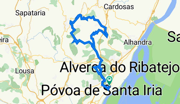
P贸voa Santa Iria - Arranh贸 - P贸voa Santa Iria
A cycling route starting in Vialonga, Lisbon District, Portugal.
Overview
About this route
P贸voa Santa Iria - Arranh贸 - P贸voa Santa Iria
- -:--
- Duration
- 45.7 km
- Distance
- 1,129 m
- Ascent
- 1,115 m
- Descent
- ---
- Avg. speed
- 364 m
- Avg. speed
Route quality
Waytypes & surfaces along the route
Waytypes
Road
13.8 km
(30 %)
Track
12.9 km
(28 %)
Surfaces
Paved
6 km
(13 %)
Unpaved
7.6 km
(17 %)
Asphalt
5.5 km
(12 %)
Unpaved (undefined)
4.2 km
(9 %)
Continue with Bikemap
Use, edit, or download this cycling route
You would like to ride P贸voa Santa Iria - Arranh贸 - P贸voa Santa Iria or customize it for your own trip? Here is what you can do with this Bikemap route:
Free features
- Save this route as favorite or in collections
- Copy & plan your own version of this route
- Sync your route with Garmin or Wahoo
Premium features
Free trial for 3 days, or one-time payment. More about Bikemap Premium.
- Navigate this route on iOS & Android
- Export a GPX / KML file of this route
- Create your custom printout (try it for free)
- Download this route for offline navigation
Discover more Premium features.
Get Bikemap PremiumFrom our community
Other popular routes starting in Vialonga
- Vialonga - Cabe莽o de Montachique - Bucelas
- Distance
- 31 km
- Ascent
- 466 m
- Descent
- 466 m
- Location
- Vialonga, Lisbon District, Portugal
- Frente Ribeirinha Tejo - Alverca-P贸voa Sta Iria
- Distance
- 6.6 km
- Ascent
- 130 m
- Descent
- 123 m
- Location
- Vialonga, Lisbon District, Portugal
- Vialonga - Arruda dos Vinhos em busca do caminho de F谩tima p...
- Distance
- 52.9 km
- Ascent
- 691 m
- Descent
- 694 m
- Location
- Vialonga, Lisbon District, Portugal
- P贸voa Santa Iria - Arranh贸 - P贸voa Santa Iria
- Distance
- 45.7 km
- Ascent
- 1,129 m
- Descent
- 1,115 m
- Location
- Vialonga, Lisbon District, Portugal
- Volta F1
- Distance
- 73.8 km
- Ascent
- 1,105 m
- Descent
- 969 m
- Location
- Vialonga, Lisbon District, Portugal
- Frente Ribeirinha Alverca-P贸voa Santa Iria
- Distance
- 6.7 km
- Ascent
- 44 m
- Descent
- 45 m
- Location
- Vialonga, Lisbon District, Portugal
- Treino - Forte da Casa - Monte Junto
- Distance
- 132.3 km
- Ascent
- 2,008 m
- Descent
- 1,941 m
- Location
- Vialonga, Lisbon District, Portugal
- Largo da Paz, Forte da Casa to Rua D Afonso Henriques 25, Estoril
- Distance
- 50.4 km
- Ascent
- 143 m
- Descent
- 140 m
- Location
- Vialonga, Lisbon District, Portugal
Open it in the app