

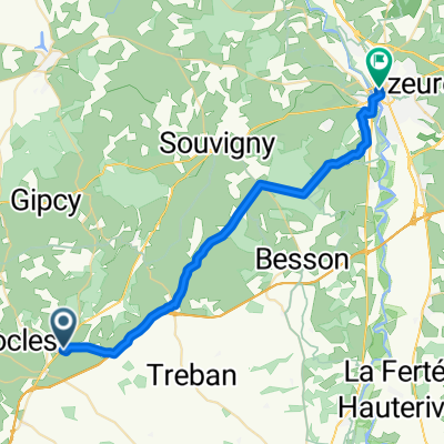
Jakob4 Conse d Allier- Saint-Yrieix-la-Perch T7/8
A cycling route starting in Buxières-les-Mines, Auvergne-Rhône-Alpes, France.
Overview
About this route
- -:--
- Duration
- 228.7 km
- Distance
- 3,190 m
- Ascent
- 3,071 m
- Descent
- ---
- Avg. speed
- 648 m
- Max. altitude

Route quality
Waytypes & surfaces along the route
Waytypes
Road
125.8 km
(55 %)
Quiet road
59.5 km
(26 %)
Surfaces
Paved
68.6 km
(30 %)
Asphalt
66.3 km
(29 %)
Concrete
2.3 km
(1 %)
Undefined
160.1 km
(70 %)
Continue with Bikemap
Use, edit, or download this cycling route
You would like to ride Jakob4 Conse d Allier- Saint-Yrieix-la-Perch T7/8 or customize it for your own trip? Here is what you can do with this Bikemap route:
Free features
- Save this route as favorite or in collections
- Copy & plan your own version of this route
- Split it into stages to create a multi-day tour
- Sync your route with Garmin or Wahoo
Premium features
Free trial for 3 days, or one-time payment. More about Bikemap Premium.
- Navigate this route on iOS & Android
- Export a GPX / KML file of this route
- Create your custom printout (try it for free)
- Download this route for offline navigation
Discover more Premium features.
Get Bikemap PremiumFrom our community
Other popular routes starting in Buxières-les-Mines
 Etape 04 - Cosne d'Allier à Chambon sur Voueize - 60,1km 570D+
- Distance
- 60.3 km
- Ascent
- 489 m
- Descent
- 385 m
- Location
- Buxières-les-Mines, Auvergne-Rhône-Alpes, France
 2023 3 - Le Montet à Les Pouges - 90.1 km +1140D+
- Distance
- 90.1 km
- Ascent
- 1,234 m
- Descent
- 1,165 m
- Location
- Buxières-les-Mines, Auvergne-Rhône-Alpes, France
 Jakob4 Conse d Allier- Saint-Yrieix-la-Perch T7/8
- Distance
- 228.7 km
- Ascent
- 3,190 m
- Descent
- 3,071 m
- Location
- Buxières-les-Mines, Auvergne-Rhône-Alpes, France
 Le Montet Montluçon 62 km
- Distance
- 62 km
- Ascent
- 441 m
- Descent
- 561 m
- Location
- Buxières-les-Mines, Auvergne-Rhône-Alpes, France
 20170529_073439.gpx
- Distance
- 60.4 km
- Ascent
- 380 m
- Descent
- 394 m
- Location
- Buxières-les-Mines, Auvergne-Rhône-Alpes, France
 5 Cosne d'Allier - Gannat
- Distance
- 59.8 km
- Ascent
- 544 m
- Descent
- 410 m
- Location
- Buxières-les-Mines, Auvergne-Rhône-Alpes, France
 cosne moulin cosne
- Distance
- 111 km
- Ascent
- 521 m
- Descent
- 512 m
- Location
- Buxières-les-Mines, Auvergne-Rhône-Alpes, France
 46.421, 3.068 to 46.566, 3.328
- Distance
- 31.1 km
- Ascent
- 125 m
- Descent
- 350 m
- Location
- Buxières-les-Mines, Auvergne-Rhône-Alpes, France
Open it in the app