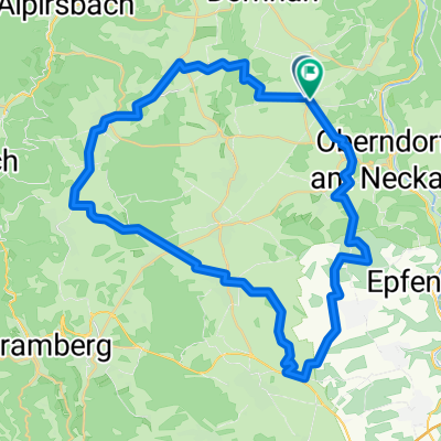
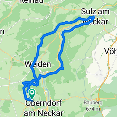
Weiden-Freudenstadt-Weiden
- 58.1 km
- 868 m
- 959 m
- Oberndorf, Baden-Wurttemberg, Germany
A cycling route starting in Oberndorf, Baden-Wurttemberg, Germany.
Overview
<span style="font-size: small; color: #000000; font-family: Times New Roman;">Landschaftlich sehr Interessant</span>
<span style="font-size: small; color: #000000; font-family: Times New Roman;">Wenige Kilometer auf der Straße</span>
<span style="font-size: 12pt; font-family: "Times New Roman"; mso-fareast-font-family: ' mso-ansi-language: DE; mso-fareast-language: DE; mso-bidi-language: AR-SA;"><span style="color: #000000;">Fast kein Kontakt zum Straßenverkehr</span></span>
created this 16 years ago
Route quality
Track
40.7 km
(70 %)
Quiet road
12.2 km
(21 %)
Paved
21.5 km
(37 %)
Unpaved
32.5 km
(56 %)
Gravel
23.2 km
(40 %)
Paved (undefined)
13.4 km
(23 %)
Continue with Bikemap
You would like to ride Weiden-Freudenstadt-Weiden or customize it for your own trip? Here is what you can do with this Bikemap route:
Free trial for 3 days, or one-time payment. More about Bikemap Premium.
Discover more Premium features.
Get Bikemap PremiumFrom our community
Open it in the app