

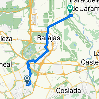
Paracaellos de Jara
A cycling route starting in San Blas-Canillejas, Madrid, Spain.
Overview
About this route
- -:--
- Duration
- 39.1 km
- Distance
- 304 m
- Ascent
- 304 m
- Descent
- ---
- Avg. speed
- ---
- Max. altitude

Continue with Bikemap
Use, edit, or download this cycling route
You would like to ride Paracaellos de Jara or customize it for your own trip? Here is what you can do with this Bikemap route:
Free features
- Save this route as favorite or in collections
- Copy & plan your own version of this route
- Sync your route with Garmin or Wahoo
Premium features
Free trial for 3 days, or one-time payment. More about Bikemap Premium.
- Navigate this route on iOS & Android
- Export a GPX / KML file of this route
- Create your custom printout (try it for free)
- Download this route for offline navigation
Discover more Premium features.
Get Bikemap PremiumFrom our community
Other popular routes starting in San Blas-Canillejas
 Casa - Ofi
- Distance
- 2.1 km
- Ascent
- 68 m
- Descent
- 83 m
- Location
- San Blas-Canillejas, Madrid, Spain
 Aeropuerto
- Distance
- 43.7 km
- Ascent
- 204 m
- Descent
- 204 m
- Location
- San Blas-Canillejas, Madrid, Spain
 anillo ciclista madrid. este norte oeste
- Distance
- 26.8 km
- Ascent
- 191 m
- Descent
- 235 m
- Location
- San Blas-Canillejas, Madrid, Spain
 De Calle de Julia García Boután a Calle Miguel de Cervantes
- Distance
- 12.9 km
- Ascent
- 49 m
- Descent
- 190 m
- Location
- San Blas-Canillejas, Madrid, Spain
 Paracaellos de Jara
- Distance
- 39.1 km
- Ascent
- 304 m
- Descent
- 304 m
- Location
- San Blas-Canillejas, Madrid, Spain
 De Madrid a Alcalá
- Distance
- 22.8 km
- Ascent
- 79 m
- Descent
- 185 m
- Location
- San Blas-Canillejas, Madrid, Spain
 Paseo con Daniel
- Distance
- 21.7 km
- Ascent
- 123 m
- Descent
- 124 m
- Location
- San Blas-Canillejas, Madrid, Spain
 Caja Mágica, camino Uclés, Rivas, Vicalvaro
- Distance
- 52.4 km
- Ascent
- 220 m
- Descent
- 224 m
- Location
- San Blas-Canillejas, Madrid, Spain
Open it in the app