

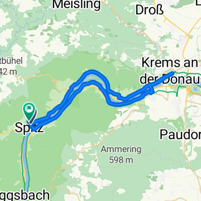
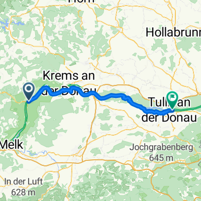
WACHAU Route
A cycling route starting in Spitz, Lower Austria, Austria.
Overview
About this route
- 2 h 36 min
- Duration
- 38.6 km
- Distance
- 393 m
- Ascent
- 394 m
- Descent
- 14.8 km/h
- Avg. speed
- 223 m
- Max. altitude

Route photos


Route quality
Waytypes & surfaces along the route
Waytypes
Track
12 km
(31 %)
Cycleway
12 km
(31 %)
Surfaces
Paved
37.8 km
(98 %)
Asphalt
36.6 km
(95 %)
Wood
0.8 km
(2 %)
Continue with Bikemap
Use, edit, or download this cycling route
You would like to ride WACHAU Route or customize it for your own trip? Here is what you can do with this Bikemap route:
Free features
- Save this route as favorite or in collections
- Copy & plan your own version of this route
- Sync your route with Garmin or Wahoo
Premium features
Free trial for 3 days, or one-time payment. More about Bikemap Premium.
- Navigate this route on iOS & Android
- Export a GPX / KML file of this route
- Create your custom printout (try it for free)
- Download this route for offline navigation
Discover more Premium features.
Get Bikemap PremiumFrom our community
Other popular routes starting in Spitz
 Route in Spitz 2
- Distance
- 39.2 km
- Ascent
- 414 m
- Descent
- 414 m
- Location
- Spitz, Lower Austria, Austria
 Wachau Rundfahrt
- Distance
- 43.1 km
- Ascent
- 198 m
- Descent
- 198 m
- Location
- Spitz, Lower Austria, Austria
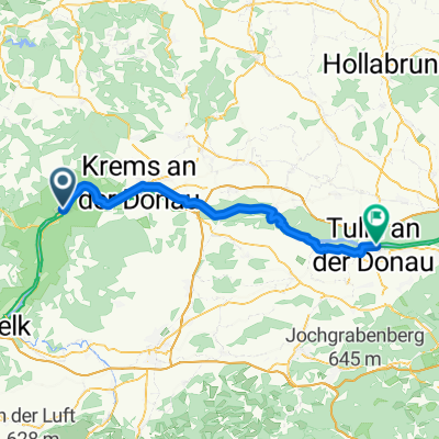 Ybbs Bahnhof - Wien: Etappe 2 bis Tulln
- Distance
- 57.9 km
- Ascent
- 140 m
- Descent
- 172 m
- Location
- Spitz, Lower Austria, Austria
 WACHAU Route
- Distance
- 38.6 km
- Ascent
- 393 m
- Descent
- 394 m
- Location
- Spitz, Lower Austria, Austria
 WACHAU TRAIL 35
- Distance
- 34.9 km
- Ascent
- 1,400 m
- Descent
- 1,435 m
- Location
- Spitz, Lower Austria, Austria
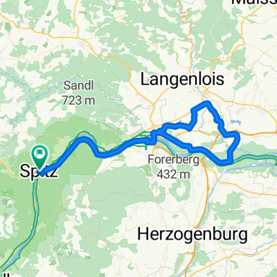 Schloss Grafenegg-79km-25
- Distance
- 78 km
- Ascent
- 544 m
- Descent
- 544 m
- Location
- Spitz, Lower Austria, Austria
 Spitz an der Donau - Tulln
- Distance
- 62.2 km
- Ascent
- 0 m
- Descent
- 26 m
- Location
- Spitz, Lower Austria, Austria
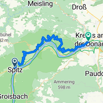
 Hinterhaus, Spitz an der Donau nach Eisentürgasse, Krems an der Donau
- Distance
- 21.2 km
- Ascent
- 114 m
- Descent
- 118 m
- Location
- Spitz, Lower Austria, Austria
Open it in the app