Entre le Massif de Haye et la Moselle
A cycling route starting in Nancy, Grand Est, France.
Overview
About this route
A beautiful loop that mixes road and forest tracks.
You climb up to Clairlieu and continue straight towards Maron. At the crossroads with the road from Chaligny, turn right onto the Route du Charbonnier and cross the Forêt de Haye until you reach the traffic light at the entrance to Velaine-en-Haye.
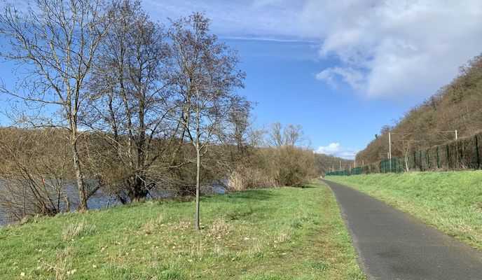
Continue straight ahead, then take the bike path that follows an old railway line. The path heads downhill towards the Moselle (great view of Villey-Saint-Étienne). In Aingeray, go under the railway line and follow the canalised Moselle to the lock, where you cross the river and join the Moselle loop cycle route.
Ride through Liverdun and continue to Pompey. When you reach the traffic light, cross the Moselle again. From Frouard, it is a tough climb up to the Plateau des Rays. Turn left in front of the forest lodge, then take the first track to the left. Follow the trail, skirt the military area (Fort de Frouard), and descend into the valley rising from Champigneulles to join the Route du Souvenir français.
Climb up to the roundabout and pass under the highway. Keep climbing straight on, then turn left when the road flattens out. From there you arrive in Clairlieu, where the loop closes.
- -:--
- Duration
- 56.8 km
- Distance
- 672 m
- Ascent
- 664 m
- Descent
- ---
- Avg. speed
- 416 m
- Max. altitude
Route photos
Route quality
Waytypes & surfaces along the route
Waytypes
Track
18.7 km
(33 %)
Road
12.5 km
(22 %)
Surfaces
Paved
28.4 km
(50 %)
Unpaved
18.2 km
(32 %)
Asphalt
28.4 km
(50 %)
Gravel
16.5 km
(29 %)
Continue with Bikemap
Use, edit, or download this cycling route
You would like to ride Entre le Massif de Haye et la Moselle or customize it for your own trip? Here is what you can do with this Bikemap route:
Free features
- Save this route as favorite or in collections
- Copy & plan your own version of this route
- Sync your route with Garmin or Wahoo
Premium features
Free trial for 3 days, or one-time payment. More about Bikemap Premium.
- Navigate this route on iOS & Android
- Export a GPX / KML file of this route
- Create your custom printout (try it for free)
- Download this route for offline navigation
Discover more Premium features.
Get Bikemap PremiumFrom our community
Other popular routes starting in Nancy
 Entre le Massif de Haye et la Moselle
- Distance
- 56.8 km
- Ascent
- 672 m
- Descent
- 664 m
- Location
- Nancy, Grand Est, France
 2015 Nancy - Bretagne - Belgien - Holland
- Distance
- 1,528.4 km
- Ascent
- 825 m
- Descent
- 1,036 m
- Location
- Nancy, Grand Est, France
 2015 Nancy - Bretagne - Belgien - Holland
- Distance
- 1,577.9 km
- Ascent
- 740 m
- Descent
- 953 m
- Location
- Nancy, Grand Est, France
 FR1 6: Nancy - Golbey; 73,3km 150hm
- Distance
- 73.3 km
- Ascent
- 238 m
- Descent
- 124 m
- Location
- Nancy, Grand Est, France
 Gravel Côte de Toul
- Distance
- 75.5 km
- Ascent
- 1,024 m
- Descent
- 1,019 m
- Location
- Nancy, Grand Est, France
 D3_Nancy to Xouaxange
- Distance
- 73.5 km
- Ascent
- 231 m
- Descent
- 156 m
- Location
- Nancy, Grand Est, France
 80 km autour de nancy
- Distance
- 86.9 km
- Ascent
- 234 m
- Descent
- 237 m
- Location
- Nancy, Grand Est, France
 Nancy-Chablis teilweise voie vertes
- Distance
- 316.4 km
- Ascent
- 721 m
- Descent
- 790 m
- Location
- Nancy, Grand Est, France
Open it in the app


