

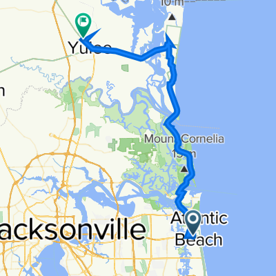
Fort George Island to American Beach
A cycling route starting in Atlantic Beach, Florida, United States.
Overview
About this route
Start at the parking lot of the Ribault Club. Gravel riding to Kingsleu Plantation. Exit to ECG next to A1A. Ride north on ECG to Aerican Beach area of Amelia Island. Lunch at Bantam and Biddy next to Harris Teeter. (plugs available outside dining)
- 1 h 6 min
- Duration
- 63.6 km
- Distance
- 192 m
- Ascent
- 195 m
- Descent
- 58.1 km/h
- Avg. speed
- 21 m
- Max. altitude
Route quality
Waytypes & surfaces along the route
Waytypes
Busy road
23.1 km
(36 %)
Quiet road
17.8 km
(28 %)
Surfaces
Paved
47.2 km
(74 %)
Asphalt
27.2 km
(43 %)
Paved (undefined)
17.4 km
(27 %)
Route highlights
Points of interest along the route
Point of interest after 34.2 km
Bantam and Biddy Lunch
Point of interest after 42.2 km
WARNING: Stay on road side of barrier when heading south. Pedestrian pathway terminates midway across bridge.
Continue with Bikemap
Use, edit, or download this cycling route
You would like to ride Fort George Island to American Beach or customize it for your own trip? Here is what you can do with this Bikemap route:
Free features
- Save this route as favorite or in collections
- Copy & plan your own version of this route
- Sync your route with Garmin or Wahoo
Premium features
Free trial for 3 days, or one-time payment. More about Bikemap Premium.
- Navigate this route on iOS & Android
- Export a GPX / KML file of this route
- Create your custom printout (try it for free)
- Download this route for offline navigation
Discover more Premium features.
Get Bikemap PremiumFrom our community
Other popular routes starting in Atlantic Beach
 1334 Blue Eagle Way E, Jacksonville to 1334 Blue Eagle Way E, Jacksonville
- Distance
- 15.7 km
- Ascent
- 20 m
- Descent
- 22 m
- Location
- Atlantic Beach, Florida, United States
 Fort George Island to American Beach
- Distance
- 63.6 km
- Ascent
- 192 m
- Descent
- 195 m
- Location
- Atlantic Beach, Florida, United States
 Royal Palms Drive 592, Atlantic Beach to Atlantic Boulevard 1073, Atlantic Beach
- Distance
- 11.2 km
- Ascent
- 13 m
- Descent
- 42 m
- Location
- Atlantic Beach, Florida, United States
 10 St. Augustine - Mayport
- Distance
- 75.3 km
- Ascent
- 34 m
- Descent
- 33 m
- Location
- Atlantic Beach, Florida, United States
 Beach to Beach Trans-Con - Day 01
- Distance
- 62.2 km
- Ascent
- 75 m
- Descent
- 47 m
- Location
- Atlantic Beach, Florida, United States
 Atlantic Boulevard 1177, Atlantic Beach to Oceangate Drive 177, Atlantic Beach
- Distance
- 87 km
- Ascent
- 191 m
- Descent
- 187 m
- Location
- Atlantic Beach, Florida, United States
 Beginning route
- Distance
- 10 km
- Ascent
- 5 m
- Descent
- 4 m
- Location
- Atlantic Beach, Florida, United States
 30.324° N -81.409° W nach 30.648° N -81.619° W
- Distance
- 62.8 km
- Ascent
- 358 m
- Descent
- 366 m
- Location
- Atlantic Beach, Florida, United States
Open it in the app