

BICIPACE 2011
Bicipace 2011 - 5 - Cesena-Pennabilli
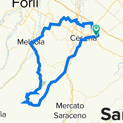
A cycling route starting in Cesena, Emilia-Romagna, Italy.
Overview
About this route
Challenging stage with continuous ups and downs and an uphill finish
Finish point:
Ostello Montefeltro via Parco Begni, 24 0541.928894
Climbing sections:
- from km 3.2 to km 6.4: 3.2 km at 6%
- from km 12.2 to km 15.8: 3.5 km at 7.5%
- from km 24.6 to km 30.2: 5.6 km at 4.5%
- from km 34.2 to km 36.5: 2.3 km at 7%
- from km 40.4 to km 46.8: 6.4 km at 2.5%
- from km 63.9 to km 67.7: 3.8 km at 5.5%
- -:--
- Duration
- 67.8 km
- Distance
- 1,472 m
- Ascent
- 1,030 m
- Descent
- ---
- Avg. speed
- ---
- Max. altitude

Part of
7 stages
Route quality
Waytypes & surfaces along the route
Waytypes
Road
21 km
(31 %)
Quiet road
7.5 km
(11 %)
Surfaces
Paved
52.2 km
(77 %)
Asphalt
52.2 km
(77 %)
Undefined
15.6 km
(23 %)
Route highlights
Points of interest along the route
Point of interest after 6.1 km
GPM1 Saiano m 254
Point of interest after 15.6 km
GPM 2 Monteleone m 356
Point of interest after 24.5 km
GPM3 Bottega Fortuna m 417
Point of interest after 36.6 km
GPM4 Bivio Meleto m 570
Point of interest after 46.9 km
GPM 5 Perticara m 677
Point of interest after 67 km
GPM 6 Pennabilli (Arrivo) m 555
Accommodation after 67.8 km
Ostello Montefeltro via Perco Begni, 24 0541.928894
Continue with Bikemap
Use, edit, or download this cycling route
You would like to ride Bicipace 2011 - 5 - Cesena-Pennabilli or customize it for your own trip? Here is what you can do with this Bikemap route:
Free features
- Save this route as favorite or in collections
- Copy & plan your own version of this route
- Sync your route with Garmin or Wahoo
Premium features
Free trial for 3 days, or one-time payment. More about Bikemap Premium.
- Navigate this route on iOS & Android
- Export a GPX / KML file of this route
- Create your custom printout (try it for free)
- Download this route for offline navigation
Discover more Premium features.
Get Bikemap PremiumFrom our community
Other popular routes starting in Cesena
 Centro Cesena - Mercato Saraceno
- Distance
- 25.6 km
- Ascent
- 355 m
- Descent
- 241 m
- Location
- Cesena, Emilia-Romagna, Italy
 Cesena - Montecodruzzo - Gualdo - Cesena
- Distance
- 44.5 km
- Ascent
- 649 m
- Descent
- 650 m
- Location
- Cesena, Emilia-Romagna, Italy
 Prima a Cesenatico! ✌🏼
- Distance
- 44.9 km
- Ascent
- 605 m
- Descent
- 596 m
- Location
- Cesena, Emilia-Romagna, Italy
 z) Anello Cesena lungo il Savio
- Distance
- 39.4 km
- Ascent
- 84 m
- Descent
- 83 m
- Location
- Cesena, Emilia-Romagna, Italy
 2 Cesena - San Leo
- Distance
- 52 km
- Ascent
- 1,129 m
- Descent
- 596 m
- Location
- Cesena, Emilia-Romagna, Italy
 C-Ponte Pietra-Borello-Ranchio-Meldola-Ponte Pietra
- Distance
- 91.2 km
- Ascent
- 1,155 m
- Descent
- 1,158 m
- Location
- Cesena, Emilia-Romagna, Italy
 Cesena - Cesenatico by PisteCiclabili.com
- Distance
- 17.6 km
- Ascent
- 9 m
- Descent
- 40 m
- Location
- Cesena, Emilia-Romagna, Italy
 Giro Donne
- Distance
- 31.9 km
- Ascent
- 510 m
- Descent
- 510 m
- Location
- Cesena, Emilia-Romagna, Italy
Open it in the app