

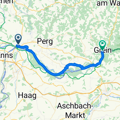
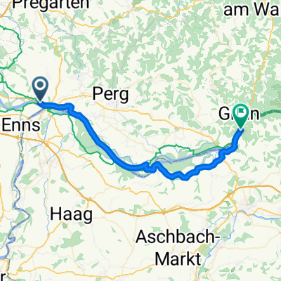
2024 Mauthausen - Grein, rote Route
A cycling route starting in Ennsdorf, Lower Austria, Austria.
Overview
About this route
- 40 min
- Duration
- 10.6 km
- Distance
- 140 m
- Ascent
- 151 m
- Descent
- 15.9 km/h
- Avg. speed
- 249 m
- Max. altitude

Route quality
Waytypes & surfaces along the route
Waytypes
Cycleway
3.4 km
(32 %)
Road
2.4 km
(23 %)
Surfaces
Paved
7.1 km
(67 %)
Unpaved
0.3 km
(3 %)
Asphalt
7 km
(66 %)
Gravel
0.3 km
(3 %)
Continue with Bikemap
Use, edit, or download this cycling route
You would like to ride 2024 Mauthausen - Grein, rote Route or customize it for your own trip? Here is what you can do with this Bikemap route:
Free features
- Save this route as favorite or in collections
- Copy & plan your own version of this route
- Sync your route with Garmin or Wahoo
Premium features
Free trial for 3 days, or one-time payment. More about Bikemap Premium.
- Navigate this route on iOS & Android
- Export a GPX / KML file of this route
- Create your custom printout (try it for free)
- Download this route for offline navigation
Discover more Premium features.
Get Bikemap PremiumFrom our community
Other popular routes starting in Ennsdorf
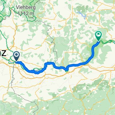
 D04 Mauthausen to Grein
- Distance
- 35.6 km
- Ascent
- 130 m
- Descent
- 117 m
- Location
- Ennsdorf, Lower Austria, Austria
 Albern, Mauthausen to Hafenstraße, Naarn im Machlande
- Distance
- 4 km
- Ascent
- 10 m
- Descent
- 12 m
- Location
- Ennsdorf, Lower Austria, Austria
 Asten - Aggsbach
- Distance
- 103.7 km
- Ascent
- 492 m
- Descent
- 523 m
- Location
- Ennsdorf, Lower Austria, Austria
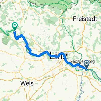 Linz - Pfarrkirchen im Mühlkreis
- Distance
- 70.9 km
- Ascent
- 539 m
- Descent
- 446 m
- Location
- Ennsdorf, Lower Austria, Austria
 From Mauthausen to Langenrohr
- Distance
- 203.3 km
- Ascent
- 858 m
- Descent
- 899 m
- Location
- Ennsdorf, Lower Austria, Austria
 Da Ennsweg a LH104
- Distance
- 80.4 km
- Ascent
- 356 m
- Descent
- 384 m
- Location
- Ennsdorf, Lower Austria, Austria
 Ufer Straße, Mauthausen nach Marktstraße, Spitz an der Donau
- Distance
- 105.7 km
- Ascent
- 795 m
- Descent
- 839 m
- Location
- Ennsdorf, Lower Austria, Austria
 Mauthausen to Grein
- Distance
- 36.4 km
- Ascent
- 157 m
- Descent
- 169 m
- Location
- Ennsdorf, Lower Austria, Austria
Open it in the app