

Calle La Cantuta, a Santa Eulalia,
A cycling route starting in Chaclacayo, Lima region, Peru.
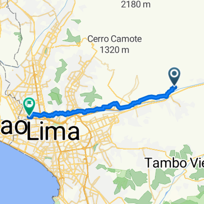
Overview
About this route
- 2 h 9 min
- Duration
- 27.9 km
- Distance
- 586 m
- Ascent
- 152 m
- Descent
- 13 km/h
- Avg. speed
- 1,031 m
- Max. altitude

Continue with Bikemap
Use, edit, or download this cycling route
You would like to ride Calle La Cantuta, a Santa Eulalia, or customize it for your own trip? Here is what you can do with this Bikemap route:
Free features
- Save this route as favorite or in collections
- Copy & plan your own version of this route
- Sync your route with Garmin or Wahoo
Premium features
Free trial for 3 days, or one-time payment. More about Bikemap Premium.
- Navigate this route on iOS & Android
- Export a GPX / KML file of this route
- Create your custom printout (try it for free)
- Download this route for offline navigation
Discover more Premium features.
Get Bikemap PremiumFrom our community
Other popular routes starting in Chaclacayo
 Calle La Cantuta, a Calle Los Pinos,
- Distance
- 9.8 km
- Ascent
- 70 m
- Descent
- 185 m
- Location
- Chaclacayo, Lima region, Peru
 lunes
lunes- Distance
- 9.6 km
- Ascent
- 145 m
- Descent
- 170 m
- Location
- Chaclacayo, Lima region, Peru
 ruta pa la UNE
- Distance
- 23.7 km
- Ascent
- 341 m
- Descent
- 179 m
- Location
- Chaclacayo, Lima region, Peru
 go club
- Distance
- 36.5 km
- Ascent
- 160 m
- Descent
- 629 m
- Location
- Chaclacayo, Lima region, Peru
 De Camino Real, Lurigancho-Chosica a Huarochirí
- Distance
- 63.3 km
- Ascent
- 8,833 m
- Descent
- 5,648 m
- Location
- Chaclacayo, Lima region, Peru
 De Cieneguilla a Cieneguilla
- Distance
- 2.1 km
- Ascent
- 55 m
- Descent
- 80 m
- Location
- Chaclacayo, Lima region, Peru
 Ruta relajada en
- Distance
- 5.2 km
- Ascent
- 141 m
- Descent
- 16 m
- Location
- Chaclacayo, Lima region, Peru
 Calle La Cantuta, a Santa Eulalia,
- Distance
- 27.9 km
- Ascent
- 586 m
- Descent
- 152 m
- Location
- Chaclacayo, Lima region, Peru
Open it in the app