
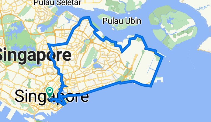
High Street - Kallang - PotongPasir - Bishan - YCK - Punggol - Pasir Ris - TMCR - ECP - Reservoir - High street
A cycling route starting in Singapore, Central Singapore Community Development Council, Singapore.
Overview
About this route
- -:--
- Duration
- 78.6 km
- Distance
- 487 m
- Ascent
- 487 m
- Descent
- ---
- Avg. speed
- 35 m
- Max. altitude

Route highlights
Points of interest along the route
Drinking water after 31.3 km
Waypoint 1 - Changi Bay Rest Point & Toilet Break
Photo after 31.9 km
Welcome to the SG Jeju! Photo Opportunity!!
Photo after 36.3 km
Waypoint 2 - Changi Beach Park Photo Opportunity & Toilet Break before heading for Dinner
Point of interest after 36.8 km
DINNER AT CHANGI!!
Drinking water after 52.9 km
Waypoint 3 - Punggol Point Park Rest Point and Photo Opportunity
Drinking water after 74 km
Waypoint 4 - Rest Point and Photo Opportunity!!
Continue with Bikemap
Use, edit, or download this cycling route
You would like to ride High Street - Kallang - PotongPasir - Bishan - YCK - Punggol - Pasir Ris - TMCR - ECP - Reservoir - High street or customize it for your own trip? Here is what you can do with this Bikemap route:
Free features
- Save this route as favorite or in collections
- Copy & plan your own version of this route
- Sync your route with Garmin or Wahoo
Premium features
Free trial for 3 days, or one-time payment. More about Bikemap Premium.
- Navigate this route on iOS & Android
- Export a GPX / KML file of this route
- Create your custom printout (try it for free)
- Download this route for offline navigation
Discover more Premium features.
Get Bikemap PremiumFrom our community
Other popular routes starting in Singapore
 Junction 10 - Pang Sua - Bollywood - Lim Chu Kang - Old Chua Chu Kang
- Distance
- 31.3 km
- Ascent
- 246 m
- Descent
- 246 m
- Location
- Singapore, Central Singapore Community Development Council, Singapore
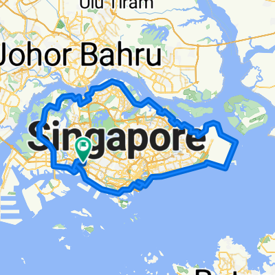 Singapore PCN Cycle Loop
- Distance
- 143.4 km
- Ascent
- 556 m
- Descent
- 538 m
- Location
- Singapore, Central Singapore Community Development Council, Singapore
 NINTENDO ISLAND TOUR - AMENDED 2
- Distance
- 75.3 km
- Ascent
- 129 m
- Descent
- 135 m
- Location
- Singapore, Central Singapore Community Development Council, Singapore
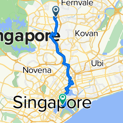 AMK ITE TO MBS
- Distance
- 13.6 km
- Ascent
- 93 m
- Descent
- 117 m
- Location
- Singapore, Central Singapore Community Development Council, Singapore
 Half of SG
- Distance
- 89.8 km
- Ascent
- 169 m
- Descent
- 173 m
- Location
- Singapore, Central Singapore Community Development Council, Singapore
 159308 Dinner to Sentosa
- Distance
- 18.7 km
- Ascent
- 317 m
- Descent
- 337 m
- Location
- Singapore, Central Singapore Community Development Council, Singapore
 Round the Island
- Distance
- 130.5 km
- Ascent
- 171 m
- Descent
- 174 m
- Location
- Singapore, Central Singapore Community Development Council, Singapore
 Punggol East, Singapore to Kallang, Singapore
- Distance
- 49.6 km
- Ascent
- 125 m
- Descent
- 130 m
- Location
- Singapore, Central Singapore Community Development Council, Singapore
Open it in the app