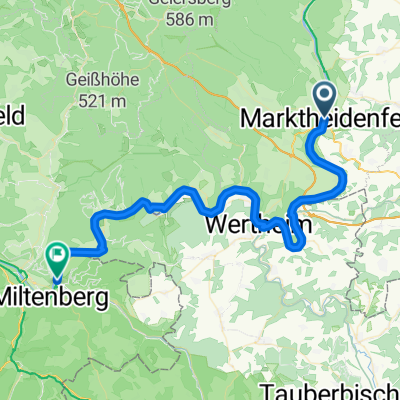
Mainschleife
- 91.9 km
- 996 m
- 908 m
- Marktheidenfeld, Bavaria, Germany
A cycling route starting in Marktheidenfeld, Bavaria, Germany.
Overview
From
http://www.bikemap.net/de/route/1253846-110727-eibelstadt-rettersheim-10-etappe/ not yet edited Connection
http://www.bikemap.net/de/route/1253866-110731-grunmorsbach-dudelsheim-12-etappe/
created this 14 years ago
Route quality
Quiet road
20.1 km
21 %
Cycleway
17.2 km
18 %
Paved
86.1 km
(90 %)
Unpaved
1 km
(1 %)
Asphalt
86.1 km
90 %
Gravel
1 km
1 %
Undefined
8.6 km
9 %
Route highlights
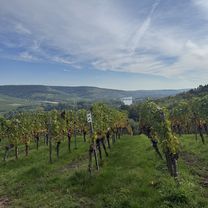
Kaffeepause
Continue with Bikemap
You would like to ride 11.07.28 Rettersheim-Grünmorsbach (11. Etappe) or customize it for your own trip? Here is what you can do with this Bikemap route:
Free trial for 3 days, or one-time payment. More about Bikemap Premium.
Discover more Premium features.
Get Bikemap PremiumFrom our community
Open it in the app