

Virgen Matrei Goldried Thörl Kals Huben Virgen
A cycling route starting in Virgen, Tyrol, Austria.
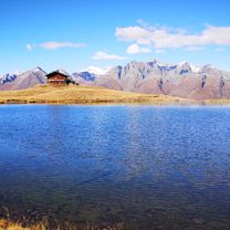
Overview
About this route
Behind the church of Matrai, always head towards 'Bergstation Goldried'. Follow the signs. Gravel from Klaunz/Schweinach (1700m ASL). From the Goldried mountain restaurant, the panoramic path goes over to Kalser Thörl.
A partly steep and narrow single trail leads about 2 km down to the middle station of the Kalser gondola. From there, it's a gravel road down to the village.
From Kals to Matrei, there is a well-built national road, moderately steep up to Huben.
- -:--
- Duration
- 58.6 km
- Distance
- 1,779 m
- Ascent
- 1,800 m
- Descent
- ---
- Avg. speed
- ---
- Max. altitude
Continue with Bikemap
Use, edit, or download this cycling route
You would like to ride Virgen Matrei Goldried Thörl Kals Huben Virgen or customize it for your own trip? Here is what you can do with this Bikemap route:
Free features
- Save this route as favorite or in collections
- Copy & plan your own version of this route
- Sync your route with Garmin or Wahoo
Premium features
Free trial for 3 days, or one-time payment. More about Bikemap Premium.
- Navigate this route on iOS & Android
- Export a GPX / KML file of this route
- Create your custom printout (try it for free)
- Download this route for offline navigation
Discover more Premium features.
Get Bikemap PremiumFrom our community
Other popular routes starting in Virgen
 CLemay_St-Veit_1
- Distance
- 77.1 km
- Ascent
- 2,057 m
- Descent
- 1,369 m
- Location
- Virgen, Tyrol, Austria
 Virgen Matrei Goldried Thörl Kals Huben Virgen
- Distance
- 58.6 km
- Ascent
- 1,779 m
- Descent
- 1,800 m
- Location
- Virgen, Tyrol, Austria
 Sankt Andrä nach 4a
- Distance
- 48.2 km
- Ascent
- 1,898 m
- Descent
- 1,837 m
- Location
- Virgen, Tyrol, Austria
 Dorfertal
- Distance
- 23.4 km
- Ascent
- 1,014 m
- Descent
- 1,014 m
- Location
- Virgen, Tyrol, Austria
 Prägraten - Matrei retour
- Distance
- 25.3 km
- Ascent
- 488 m
- Descent
- 488 m
- Location
- Virgen, Tyrol, Austria
 pragraten-johannishutte
- Distance
- 7.2 km
- Ascent
- 870 m
- Descent
- 88 m
- Location
- Virgen, Tyrol, Austria
 Niedermauern-Gries 2 nach Unnamed Road
- Distance
- 9.4 km
- Ascent
- 1,037 m
- Descent
- 12 m
- Location
- Virgen, Tyrol, Austria
 Staller Sattel
- Distance
- 18.8 km
- Ascent
- 881 m
- Descent
- 161 m
- Location
- Virgen, Tyrol, Austria
Open it in the app