

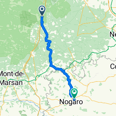
Captieux à 9 Rue Brauhauban, Tarbes
A cycling route starting in Préchac, Nouvelle-Aquitaine, France.
Overview
About this route
- 8 h 50 min
- Duration
- 137.1 km
- Distance
- 852 m
- Ascent
- 653 m
- Descent
- 15.5 km/h
- Avg. speed
- 317 m
- Max. altitude
Route quality
Waytypes & surfaces along the route
Waytypes
Road
67.7 km
(49 %)
Busy road
33.5 km
(24 %)
Surfaces
Paved
45.1 km
(33 %)
Unpaved
11 km
(8 %)
Asphalt
45.1 km
(33 %)
Gravel
8.6 km
(6 %)
Continue with Bikemap
Use, edit, or download this cycling route
You would like to ride Captieux à 9 Rue Brauhauban, Tarbes or customize it for your own trip? Here is what you can do with this Bikemap route:
Free features
- Save this route as favorite or in collections
- Copy & plan your own version of this route
- Split it into stages to create a multi-day tour
- Sync your route with Garmin or Wahoo
Premium features
Free trial for 3 days, or one-time payment. More about Bikemap Premium.
- Navigate this route on iOS & Android
- Export a GPX / KML file of this route
- Create your custom printout (try it for free)
- Download this route for offline navigation
Discover more Premium features.
Get Bikemap PremiumFrom our community
Other popular routes starting in Préchac
 Recovered Route
- Distance
- 2.6 km
- Ascent
- 0 m
- Descent
- 6 m
- Location
- Préchac, Nouvelle-Aquitaine, France
 De 254A Peyredieu Nord, Préchac à Grihon, Préchac
- Distance
- 0.9 km
- Ascent
- 8 m
- Descent
- 0 m
- Location
- Préchac, Nouvelle-Aquitaine, France
 22 Captieux - St. Server Jakobsweg
- Distance
- 79.2 km
- Ascent
- 236 m
- Descent
- 228 m
- Location
- Préchac, Nouvelle-Aquitaine, France
 Préchac - Nogaro
- Distance
- 72.7 km
- Ascent
- 569 m
- Descent
- 587 m
- Location
- Préchac, Nouvelle-Aquitaine, France
 96 La Hausse, Captieux à 8 Résidence Peyre Dussillol, Captieux
- Distance
- 15.6 km
- Ascent
- 111 m
- Descent
- 105 m
- Location
- Préchac, Nouvelle-Aquitaine, France
 10_Cazalis-Carresse
- Distance
- 124.6 km
- Ascent
- 520 m
- Descent
- 586 m
- Location
- Préchac, Nouvelle-Aquitaine, France
 Itinéraire à partir de Route du Fond du Moulin, Bernos-Beaulac
- Distance
- 7.1 km
- Ascent
- 18 m
- Descent
- 3 m
- Location
- Préchac, Nouvelle-Aquitaine, France
 Captieux à 9 Rue Brauhauban, Tarbes
- Distance
- 137.1 km
- Ascent
- 852 m
- Descent
- 653 m
- Location
- Préchac, Nouvelle-Aquitaine, France
Open it in the app