

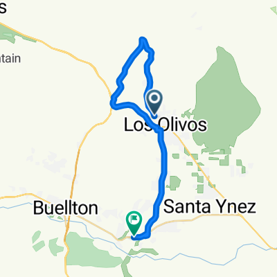
3035 Figueroa Mountain Rd, Santa Ynez to 2400–2428 Alamo Pintado Ave, Los Olivos
A cycling route starting in Los Olivos, California, United States of America.
Overview
About this route
- 2 h 20 min
- Duration
- 42.1 km
- Distance
- 1,903 m
- Ascent
- 1,907 m
- Descent
- 18 km/h
- Avg. speed
- 1,037 m
- Max. altitude
Route quality
Waytypes & surfaces along the route
Waytypes
Quiet road
41.9 km
(100 %)
Road
0.1 km
(<1 %)
Undefined
-0 km
(<1 %)
Surfaces
Paved
6.4 km
(15 %)
Paved (undefined)
6.4 km
(15 %)
Asphalt
0.1 km
(<1 %)
Undefined
35.7 km
(85 %)
Continue with Bikemap
Use, edit, or download this cycling route
You would like to ride 3035 Figueroa Mountain Rd, Santa Ynez to 2400–2428 Alamo Pintado Ave, Los Olivos or customize it for your own trip? Here is what you can do with this Bikemap route:
Free features
- Save this route as favorite or in collections
- Copy & plan your own version of this route
- Sync your route with Garmin or Wahoo
Premium features
Free trial for 3 days, or one-time payment. More about Bikemap Premium.
- Navigate this route on iOS & Android
- Export a GPX / KML file of this route
- Create your custom printout (try it for free)
- Download this route for offline navigation
Discover more Premium features.
Get Bikemap PremiumFrom our community
Other popular routes starting in Los Olivos
 Slow ride in Los Olivos
- Distance
- 16.1 km
- Ascent
- 120 m
- Descent
- 120 m
- Location
- Los Olivos, California, United States of America
 2971 Grand Ave, Los Olivos to 400 Camino San Carlos, Buellton
- Distance
- 17 km
- Ascent
- 180 m
- Descent
- 247 m
- Location
- Los Olivos, California, United States of America
 Santa Barbara Avenue 2679, Solvang to Santa Barbara Avenue 2679, Solvang
- Distance
- 29.3 km
- Ascent
- 367 m
- Descent
- 369 m
- Location
- Los Olivos, California, United States of America
 2356 Alamo Pintado Ave, Los Olivos to 3156–3158 Roblar Ave, Santa Ynez
- Distance
- 3.5 km
- Ascent
- 14 m
- Descent
- 32 m
- Location
- Los Olivos, California, United States of America
 3010 Roblar Ave, Santa Ynez to 3010 Roblar Ave, Santa Ynez
- Distance
- 14 km
- Ascent
- 146 m
- Descent
- 149 m
- Location
- Los Olivos, California, United States of America
 Route from 3256–3262 Foxen Canyon Rd, Los Olivos
- Distance
- 25.8 km
- Ascent
- 249 m
- Descent
- 362 m
- Location
- Los Olivos, California, United States of America
 2648 Oakcrest Ln, Santa Ynez to 2435 Baseline Ave, Solvang
- Distance
- 6.9 km
- Ascent
- 34 m
- Descent
- 83 m
- Location
- Los Olivos, California, United States of America
 2375 Alamo Pintado Ave, Los Olivos to 487 Atterdag Rd, Solvang
- Distance
- 13.9 km
- Ascent
- 172 m
- Descent
- 277 m
- Location
- Los Olivos, California, United States of America
Open it in the app