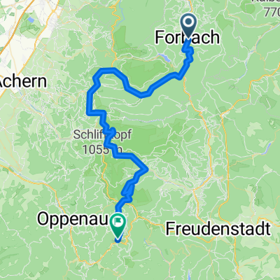
Westweg_2.Etappe
A cycling route starting in Forbach, Baden-Württemberg, Germany.
Overview
About this route
Westweg_2.Etappe :
Forbach , Schwarzenbachstausee, Sand, Hundseck, Hornisgrinde, Schliffkopf, Alexanderschanze,
Harkhof
- -:--
- Duration
- 62.6 km
- Distance
- 1,546 m
- Ascent
- 1,176 m
- Descent
- ---
- Avg. speed
- ---
- Avg. speed
Continue with Bikemap
Use, edit, or download this cycling route
You would like to ride Westweg_2.Etappe or customize it for your own trip? Here is what you can do with this Bikemap route:
Free features
- Save this route as favorite or in collections
- Copy & plan your own version of this route
- Sync your route with Garmin or Wahoo
Premium features
Free trial for 3 days, or one-time payment. More about Bikemap Premium.
- Navigate this route on iOS & Android
- Export a GPX / KML file of this route
- Create your custom printout (try it for free)
- Download this route for offline navigation
Discover more Premium features.
Get Bikemap PremiumFrom our community
Other popular routes starting in Forbach
- Schwarzwald Umrundung
- Distance
- 448.6 km
- Ascent
- 2,986 m
- Descent
- 2,986 m
- Location
- Forbach, Baden-Württemberg, Germany
- Forbach - Giersteine - Alter Sportplatz - Antoniusbrunnen - Holzbrücke - Forbach
- Distance
- 7 km
- Ascent
- 284 m
- Descent
- 286 m
- Location
- Forbach, Baden-Württemberg, Germany
- Winterhardtstraße, Forbach nach Murgtalstraße, Forbach
- Distance
- 24.3 km
- Ascent
- 1,047 m
- Descent
- 1,132 m
- Location
- Forbach, Baden-Württemberg, Germany
- Westweg_2.Etappe
- Distance
- 62.6 km
- Ascent
- 1,546 m
- Descent
- 1,176 m
- Location
- Forbach, Baden-Württemberg, Germany
- Schwarzwald 02: Forbach - Bad Peterstal
- Distance
- 71.4 km
- Ascent
- 1,272 m
- Descent
- 1,171 m
- Location
- Forbach, Baden-Württemberg, Germany
- Forbach - Wildgehege - Holzschuhrank - PiccosHütte - Badner Höhe - Schwarzenbach - Forbach
- Distance
- 28.5 km
- Ascent
- 781 m
- Descent
- 781 m
- Location
- Forbach, Baden-Württemberg, Germany
- Baden-Baden nach Herrenwies 35, Forbach
- Distance
- 11 km
- Ascent
- 318 m
- Descent
- 195 m
- Location
- Forbach, Baden-Württemberg, Germany
- Zum Hohlohturm auf 990m
- Distance
- 27.6 km
- Ascent
- 854 m
- Descent
- 857 m
- Location
- Forbach, Baden-Württemberg, Germany
Open it in the app