BSD - Dangdang - Suradita
A cycling route starting in South Tangerang, Banten, Indonesia.
Overview
About this route
- 2 h 6 min
- Duration
- 37.1 km
- Distance
- 175 m
- Ascent
- 191 m
- Descent
- 17.7 km/h
- Avg. speed
- 86 m
- Max. altitude
Route photos
Route quality
Waytypes & surfaces along the route
Waytypes
Quiet road
13 km
(35 %)
Road
4.8 km
(13 %)
Surfaces
Paved
18.9 km
(51 %)
Asphalt
13.7 km
(37 %)
Concrete
5.2 km
(14 %)
Undefined
18.2 km
(49 %)
Continue with Bikemap
Use, edit, or download this cycling route
You would like to ride BSD - Dangdang - Suradita or customize it for your own trip? Here is what you can do with this Bikemap route:
Free features
- Save this route as favorite or in collections
- Copy & plan your own version of this route
- Sync your route with Garmin or Wahoo
Premium features
Free trial for 3 days, or one-time payment. More about Bikemap Premium.
- Navigate this route on iOS & Android
- Export a GPX / KML file of this route
- Create your custom printout (try it for free)
- Download this route for offline navigation
Discover more Premium features.
Get Bikemap PremiumFrom our community
Other popular routes starting in South Tangerang
Japinka-JPG BSD- Distance
- 6.2 km
- Ascent
- 39 m
- Descent
- 41 m
- Location
- South Tangerang, Banten, Indonesia
RJ Blusukan Rad 15Km- Distance
- 24.8 km
- Ascent
- 109 m
- Descent
- 123 m
- Location
- South Tangerang, Banten, Indonesia
BSD - Dangdang - Suradita- Distance
- 37.1 km
- Ascent
- 175 m
- Descent
- 191 m
- Location
- South Tangerang, Banten, Indonesia
Route in Tangerang City- Distance
- 22.9 km
- Ascent
- 120 m
- Descent
- 126 m
- Location
- South Tangerang, Banten, Indonesia
Jalan Bulak Wangi III 16, Kecamatan Pamulang to Jalan Haji Somad/Gg. Doel 37, Kecamatan Setiabudi- Distance
- 20 km
- Ascent
- 134 m
- Descent
- 165 m
- Location
- South Tangerang, Banten, Indonesia
the sport of riding a mountain bike- Distance
- 6 km
- Ascent
- 37 m
- Descent
- 34 m
- Location
- South Tangerang, Banten, Indonesia
PonPin - Bintaro - Pamulang - JPG - PonPin- Distance
- 38.5 km
- Ascent
- 525 m
- Descent
- 525 m
- Location
- South Tangerang, Banten, Indonesia
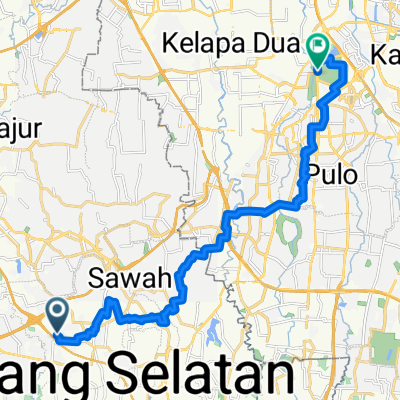
Gang Haji Mait to Gang Haji Mait No.18- Distance
- 15.9 km
- Ascent
- 214 m
- Descent
- 218 m
- Location
- South Tangerang, Banten, Indonesia
Open it in the app


