

2023 Ellwangen
Einrolltour Dinkelsbühl
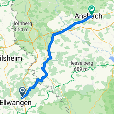
A cycling route starting in Ellwangen, Baden-Wurttemberg, Germany.
Overview
About this route
- -:--
- Duration
- 50.2 km
- Distance
- 708 m
- Ascent
- 708 m
- Descent
- ---
- Avg. speed
- 576 m
- Max. altitude

Part of
2023 Ellwangen
9 stages
Route quality
Waytypes & surfaces along the route
Waytypes
Quiet road
19.1 km
(38 %)
Road
12.5 km
(25 %)
Surfaces
Paved
32.6 km
(65 %)
Unpaved
2.5 km
(5 %)
Asphalt
25.6 km
(51 %)
Paved (undefined)
7 km
(14 %)
Continue with Bikemap
Use, edit, or download this cycling route
You would like to ride Einrolltour Dinkelsbühl or customize it for your own trip? Here is what you can do with this Bikemap route:
Free features
- Save this route as favorite or in collections
- Copy & plan your own version of this route
- Sync your route with Garmin or Wahoo
Premium features
Free trial for 3 days, or one-time payment. More about Bikemap Premium.
- Navigate this route on iOS & Android
- Export a GPX / KML file of this route
- Create your custom printout (try it for free)
- Download this route for offline navigation
Discover more Premium features.
Get Bikemap PremiumFrom our community
Other popular routes starting in Ellwangen
 Ellwangen durch Feld Wald Seen
- Distance
- 50.5 km
- Ascent
- 335 m
- Descent
- 337 m
- Location
- Ellwangen, Baden-Wurttemberg, Germany
 Bayernrunde
- Distance
- 68.6 km
- Ascent
- 433 m
- Descent
- 434 m
- Location
- Ellwangen, Baden-Wurttemberg, Germany
 trert
trert- Distance
- 32.5 km
- Ascent
- 290 m
- Descent
- 281 m
- Location
- Ellwangen, Baden-Wurttemberg, Germany
 Ellwangen - Ansbach
- Distance
- 62.3 km
- Ascent
- 632 m
- Descent
- 739 m
- Location
- Ellwangen, Baden-Wurttemberg, Germany
 Kocher-Jagst-Tour Teil 3
- Distance
- 84.3 km
- Ascent
- 1,181 m
- Descent
- 1,352 m
- Location
- Ellwangen, Baden-Wurttemberg, Germany
 Einfache Fahrt in
- Distance
- 15 km
- Ascent
- 174 m
- Descent
- 178 m
- Location
- Ellwangen, Baden-Wurttemberg, Germany
 2019 Ellwangen NE Ellwangen
- Distance
- 214.3 km
- Ascent
- 999 m
- Descent
- 999 m
- Location
- Ellwangen, Baden-Wurttemberg, Germany
 2010-Tag11(Teil2): Schwabsberg-Burg Rechenberg 2010
- Distance
- 19.9 km
- Ascent
- 166 m
- Descent
- 167 m
- Location
- Ellwangen, Baden-Wurttemberg, Germany
Open it in the app