

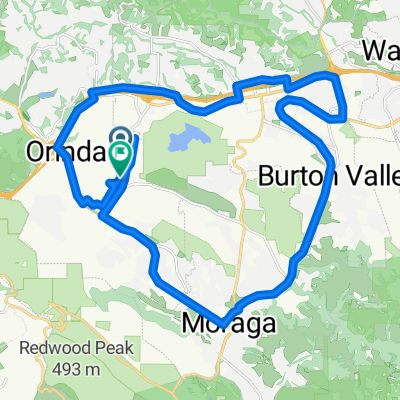
Orinda BART - diablo southgate
A cycling route starting in Orinda, California, United States.
Overview
About this route
- -:--
- Duration
- 75.6 km
- Distance
- 853 m
- Ascent
- 853 m
- Descent
- ---
- Avg. speed
- ---
- Max. altitude
Route quality
Waytypes & surfaces along the route
Waytypes
Quiet road
29.6 km
(39 %)
Busy road
21.7 km
(29 %)
Surfaces
Paved
30.4 km
(40 %)
Asphalt
22.9 km
(30 %)
Paved (undefined)
7.5 km
(10 %)
Undefined
45.2 km
(60 %)
Continue with Bikemap
Use, edit, or download this cycling route
You would like to ride Orinda BART - diablo southgate or customize it for your own trip? Here is what you can do with this Bikemap route:
Free features
- Save this route as favorite or in collections
- Copy & plan your own version of this route
- Sync your route with Garmin or Wahoo
Premium features
Free trial for 3 days, or one-time payment. More about Bikemap Premium.
- Navigate this route on iOS & Android
- Export a GPX / KML file of this route
- Create your custom printout (try it for free)
- Download this route for offline navigation
Discover more Premium features.
Get Bikemap PremiumFrom our community
Other popular routes starting in Orinda
 LaMOrinda half loop
- Distance
- 42 km
- Ascent
- 481 m
- Descent
- 470 m
- Location
- Orinda, California, United States
 Low-Key Hillclimb: Lomas Cantadas via Loma Vista, El Toyonal
- Distance
- 3.9 km
- Ascent
- 370 m
- Descent
- 51 m
- Location
- Orinda, California, United States
 GPC ASSR Adente (34 mile)
- Distance
- 51.3 km
- Ascent
- 659 m
- Descent
- 660 m
- Location
- Orinda, California, United States
 "The Bears" Individual Time Trial (Grizzly Peak Cyclists) CLONED FROM ROUTE 321207
- Distance
- 30.2 km
- Ascent
- 524 m
- Descent
- 534 m
- Location
- Orinda, California, United States
 Three Bears, Orinda, CA (Loop only)
- Distance
- 30.1 km
- Ascent
- 513 m
- Descent
- 524 m
- Location
- Orinda, California, United States
 Around Orinda
- Distance
- 24 km
- Ascent
- 366 m
- Descent
- 370 m
- Location
- Orinda, California, United States
 lamo loop
- Distance
- 38 km
- Ascent
- 311 m
- Descent
- 319 m
- Location
- Orinda, California, United States
 Castro Ranch Alhambra Reliez Happy Valley plus a Bear.
- Distance
- 50 km
- Ascent
- 733 m
- Descent
- 733 m
- Location
- Orinda, California, United States
Open it in the app