

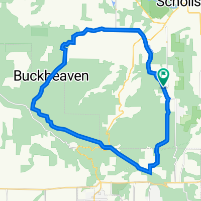
MtnTop-McCormickHill-MtnHome Loop
A cycling route starting in Sherwood, Oregon, United States.
Overview
About this route
Portions of this route are unpaved/gravel. Unpaved can be hard pack and as smooth as pavement, gravel portions can be loose gravel depending on how recently it was put down. Most of the unpaved is hard pack and bikes with 2"+ do fine. I have ridden my e-bike and this is a great loop with some beautiful countryside. Be careful along Vanderschuere which has no shoulder and can be busy with cars at times between Neugebauer and Hwy 219.
- -:--
- Duration
- 22.5 km
- Distance
- 523 m
- Ascent
- 523 m
- Descent
- ---
- Avg. speed
- 433 m
- Max. altitude
Route quality
Waytypes & surfaces along the route
Waytypes
Road
15.5 km
(69 %)
Quiet road
6.8 km
(30 %)
Surfaces
Paved
18 km
(80 %)
Unpaved
2.8 km
(13 %)
Asphalt
18 km
(80 %)
Unpaved (undefined)
1.6 km
(7 %)
Continue with Bikemap
Use, edit, or download this cycling route
You would like to ride MtnTop-McCormickHill-MtnHome Loop or customize it for your own trip? Here is what you can do with this Bikemap route:
Free features
- Save this route as favorite or in collections
- Copy & plan your own version of this route
- Sync your route with Garmin or Wahoo
Premium features
Free trial for 3 days, or one-time payment. More about Bikemap Premium.
- Navigate this route on iOS & Android
- Export a GPX / KML file of this route
- Create your custom printout (try it for free)
- Download this route for offline navigation
Discover more Premium features.
Get Bikemap PremiumFrom our community
Other popular routes starting in Sherwood
 Sherwood/Roy Rogers Loop
- Distance
- 12.5 km
- Ascent
- 204 m
- Descent
- 204 m
- Location
- Sherwood, Oregon, United States
 Coast Range Century
- Distance
- 159.9 km
- Ascent
- 2,110 m
- Descent
- 2,111 m
- Location
- Sherwood, Oregon, United States
 Chehalem Loop (in progress)
- Distance
- 38 km
- Ascent
- 835 m
- Descent
- 826 m
- Location
- Sherwood, Oregon, United States
 Sherwood 65 through Champoeg State Park
- Distance
- 103.1 km
- Ascent
- 632 m
- Descent
- 632 m
- Location
- Sherwood, Oregon, United States
 SW Roy Rogers Rd, Sherwood to 15113 SW Cabernet Dr, Portland
- Distance
- 12.1 km
- Ascent
- 170 m
- Descent
- 65 m
- Location
- Sherwood, Oregon, United States
 xfgxf
xfgxf- Distance
- 358.2 km
- Ascent
- 694 m
- Descent
- 757 m
- Location
- Sherwood, Oregon, United States
 MtnTop-McCormickHill-MtnHome Loop
- Distance
- 22.5 km
- Ascent
- 523 m
- Descent
- 523 m
- Location
- Sherwood, Oregon, United States
 19255 SW Pacific Hwy, Sherwood to 13907 SW Andrew Terr, Tigard
- Distance
- 8.7 km
- Ascent
- 78 m
- Descent
- 49 m
- Location
- Sherwood, Oregon, United States
Open it in the app