

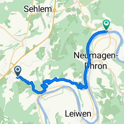
Bekond-Meulenwald-Quint-Schweich-Bekond
A cycling route starting in Bekond, Rhineland-Palatinate, Germany.
Overview
About this route
- 2 h 23 min
- Duration
- 31.7 km
- Distance
- 673 m
- Ascent
- 674 m
- Descent
- 13.3 km/h
- Avg. speed
- 354 m
- Max. altitude

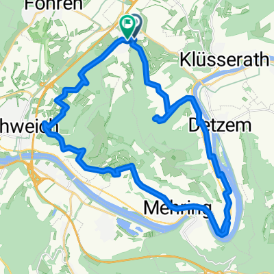
Route photos


Route quality
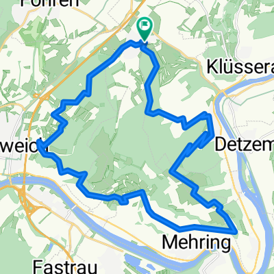
Waytypes & surfaces along the route
Waytypes
Track
20.6 km
(65 %)
Quiet road
3.8 km
(12 %)
Surfaces
Paved
8.6 km
(27 %)
Unpaved
19.6 km
(62 %)
Gravel
14.9 km
(47 %)
Asphalt
7.9 km
(25 %)
Continue with Bikemap
Use, edit, or download this cycling route
You would like to ride Bekond-Meulenwald-Quint-Schweich-Bekond or customize it for your own trip? Here is what you can do with this Bikemap route:
Free features
- Save this route as favorite or in collections
- Copy & plan your own version of this route
- Sync your route with Garmin or Wahoo
Premium features
Free trial for 3 days, or one-time payment. More about Bikemap Premium.
- Navigate this route on iOS & Android
- Export a GPX / KML file of this route
- Create your custom printout (try it for free)
- Download this route for offline navigation
Discover more Premium features.
Get Bikemap PremiumFrom our community
Other popular routes starting in Bekond
 Strecke des IRT-BENEFIZ-RADTOUR
- Distance
- 7.7 km
- Ascent
- 28 m
- Descent
- 27 m
- Location
- Bekond, Rhineland-Palatinate, Germany
 Moselstraße 55A, Bekond nach Moselstraße 55, Bekond
- Distance
- 25.6 km
- Ascent
- 487 m
- Descent
- 488 m
- Location
- Bekond, Rhineland-Palatinate, Germany
 Bekond-Piesport
- Distance
- 16.8 km
- Ascent
- 423 m
- Descent
- 526 m
- Location
- Bekond, Rhineland-Palatinate, Germany
 Kieskaule und Mosel Tour
- Distance
- 32.5 km
- Ascent
- 244 m
- Descent
- 240 m
- Location
- Bekond, Rhineland-Palatinate, Germany
 Hammer Blick 🤠 – Aussichtsturm Fünf-Seen-Blick Runde von Föhren - Hammer Blick 🤠 – Aussichtsturm Fünf-Seen-Blick Runde von Föhren
- Distance
- 35.1 km
- Ascent
- 901 m
- Descent
- 902 m
- Location
- Bekond, Rhineland-Palatinate, Germany
 Rundweg Mosel
- Distance
- 31.8 km
- Ascent
- 1,114 m
- Descent
- 1,114 m
- Location
- Bekond, Rhineland-Palatinate, Germany
 Bekond Runde Pölich-Schweich
- Distance
- 24.9 km
- Ascent
- 836 m
- Descent
- 836 m
- Location
- Bekond, Rhineland-Palatinate, Germany
 Bekond-Finnenbahn-Annaberg-Bekond
- Distance
- 27.2 km
- Ascent
- 784 m
- Descent
- 774 m
- Location
- Bekond, Rhineland-Palatinate, Germany
Open it in the app